FinnsAway blog – nomad life and travel adventures
Menu
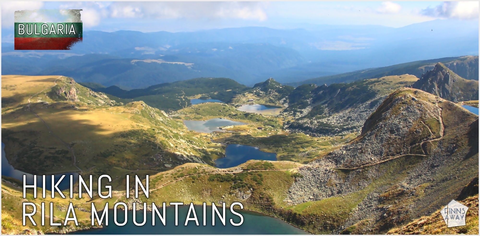
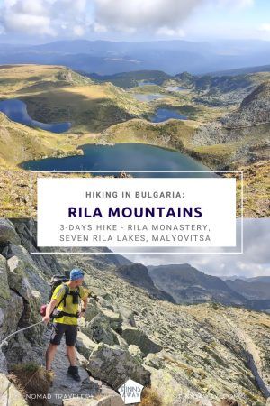
3-days hike in Rila Mountains in Bulgaria
Published: April 12, 2023
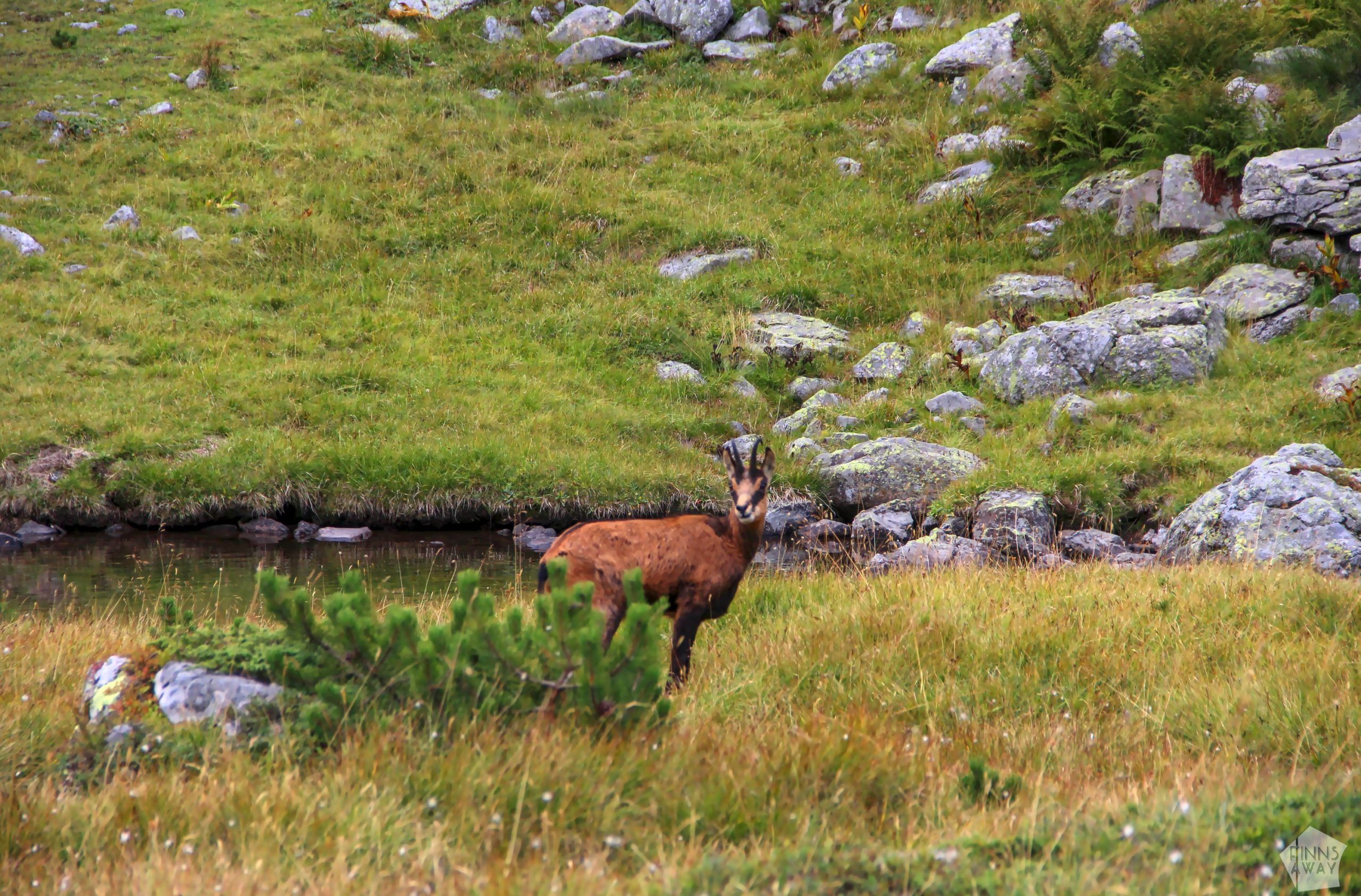
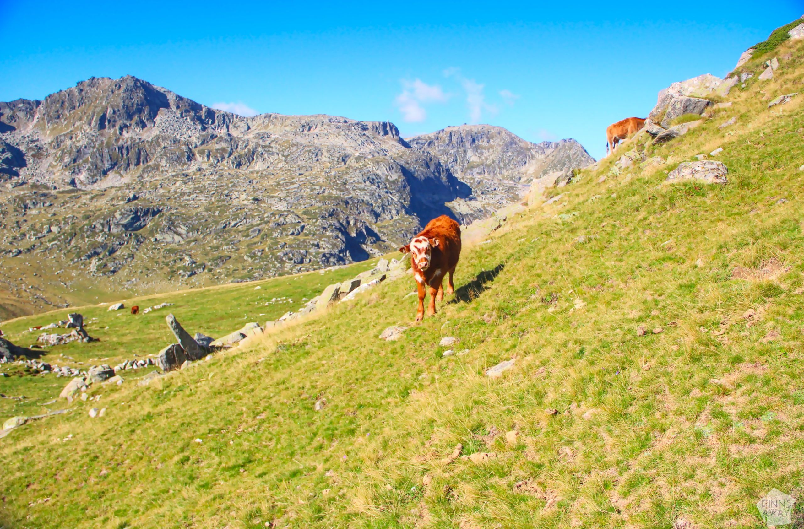
Rila Mountains, the highest mountain range of Bulgaria, of the Balkan Peninsula and of the whole Southeast Europe, is a wonderful destination for hiking for both short and longer treks. With amazing mountain lakes, rugged peaks (more than 100 peaks over 2000 meters!) and grassy valleys, the walks along the marked trails of Rila offer stunning views. Our three-days hike in September 2022 included sunshine and cloudy skies, beautiful views of mountain lakes and steep cliffs, nice meetings with other hikers, a lot of grazing horses, sheep, shepherd dogs and cows, as well as spotting some chamois and a roe deer. In this post we first talk about Rila Mountains in general, then introduce the route of our hike day by day and share tips for planning your hike.
Rila National Park protects mountain nature
Located in Southwest Bulgaria, Rila partly belongs in the Rhodope Massif mountain range. Rila National Park was established in 1992 to protect the ecosystems and nature of the Rila Mountains. In this extensive nature reserve (more than 81 hectares) there are more than 120 mountain lakes and several high mountain peaks, including the highest peak of the Balkans, Musala (2,925 meters above sea level). The flora and fauna of the Rila Mountains are diverse, and you can find there, for example, 48 different species of mammals, from deer to wolves and from squirrels to bears.
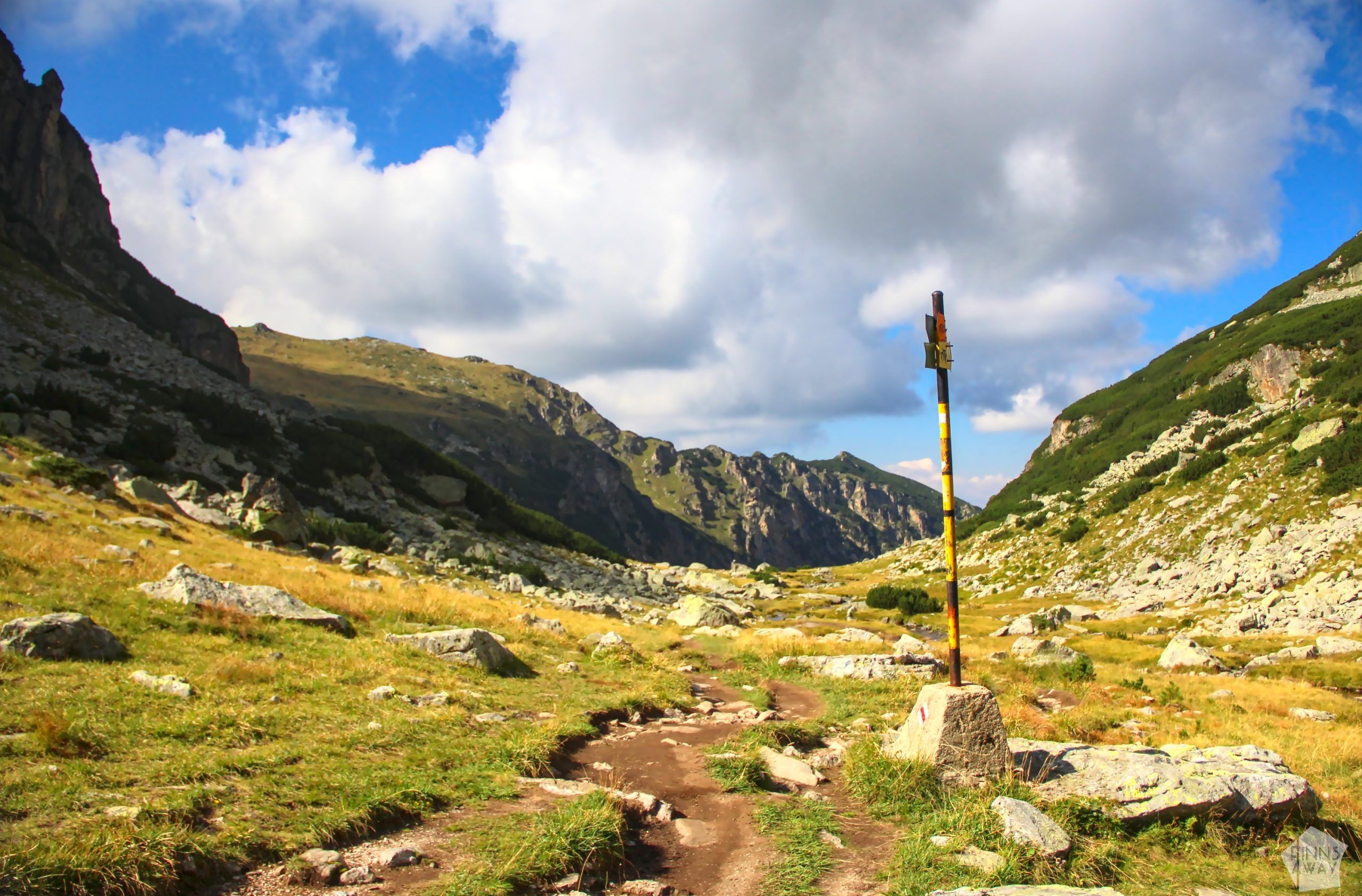
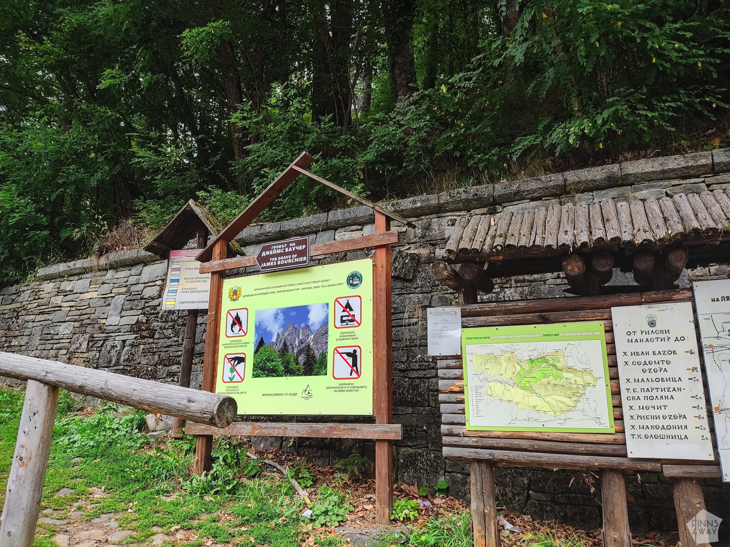
A network of hiking trails runs on the Rila Mountains, and also two European long-distance hiking trails, E4 and E8, run through the area. To accommodate hikers, there are several big mountain huts with restaurant services, and also some simple, unoccupied shelters to protect hikers from bad weather and to stay overnight. In the mountain area there are also relatively large wilderness areas without any marked trails, and in addition there is a significant water reserve area, that is completely closed to visitors. The hiking trails of the Rila Mountains can be accessed from numerous different starting points on different sides of the mountain range, and at the beginning of some of the trails it’s also possible to use ski lifts. A lift ride is an easy way to get close to the famous The Seven Lakes of Rila, for example. The Rila mountain area is divided into four different parts according to the deep valleys that cut through it.
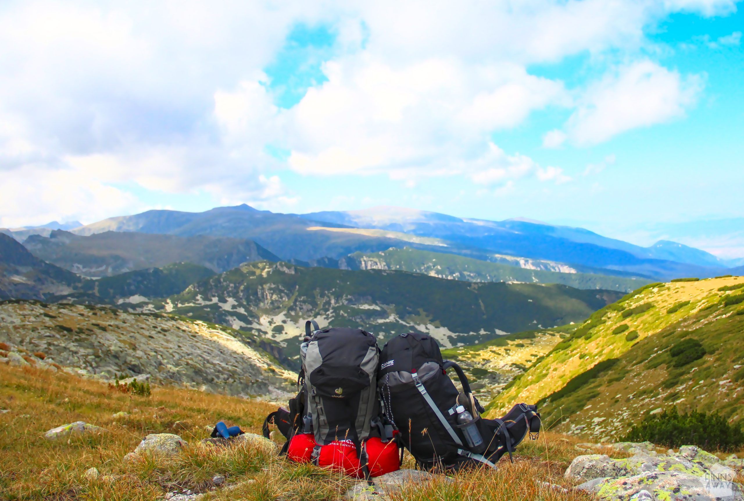
Hikers surely have plenty of paths to choose from in the Rila region, but planning a suitable route for a longer circular hike was still a bit challenging. Due to the large differences in elevation and partly difficult terrain, the daily stages cannot be super long, so if you want to explore different parts of the mountain range comprehensively, you need to allow plenty of time for the hike. We ended up focusing on the Malyovitsa Rila area in the northwestern parts of the mountain range. We reserved three to four days, leaving the final part of the hike open so that we could choose from a couple of different options depending on how fast we would walk in practice. We packed camping equipment with us, so we were not dependent on the services of the mountain huts, and thus had more freedom to modify the route along the way.
Day 1: From Rila Monastery to Ivan Vazov hut
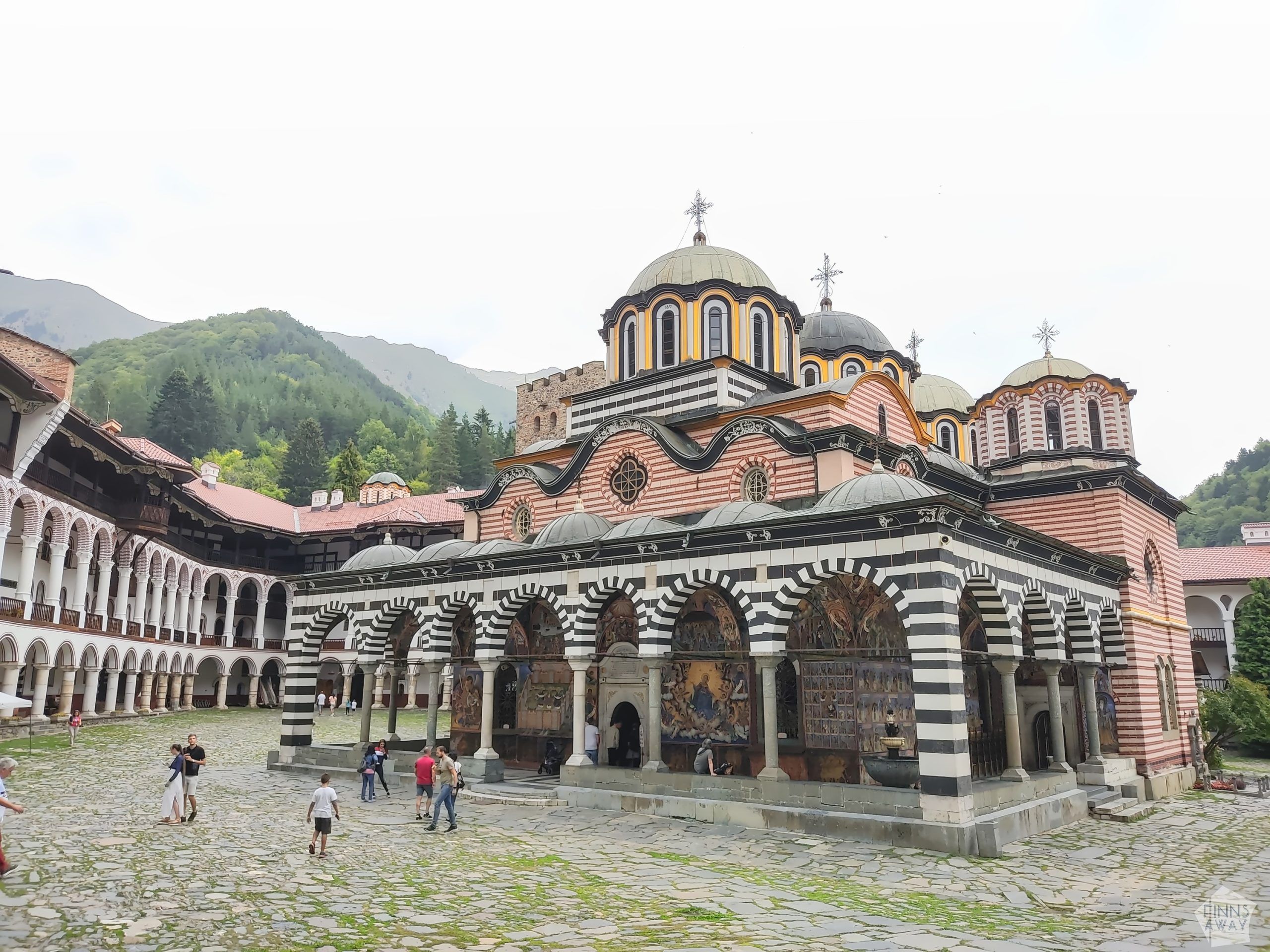
We hit the trails from the famous Rila Monastery, that is a stunning, historically significant site located in the valley of Rilska River on the southwestern side of the mountains. If you have your own wheels, it’s super easy to reach the monastery, but there are also bus connections from Sofia via Dupnitsa and from Blagoevgrad. We had stayed the previous night in Camping Bor, a small camping site just one km from the monastery, and were allowed to leave our camper van there for a few days.
Before starting the hike, we needed some time for packing and preparing, so it was already afternoon when we finally left the camping site behind. We first walked to the monastery, found the trail head right next to it and took the path that leads up towards the Ivan Vazov mountain hut.
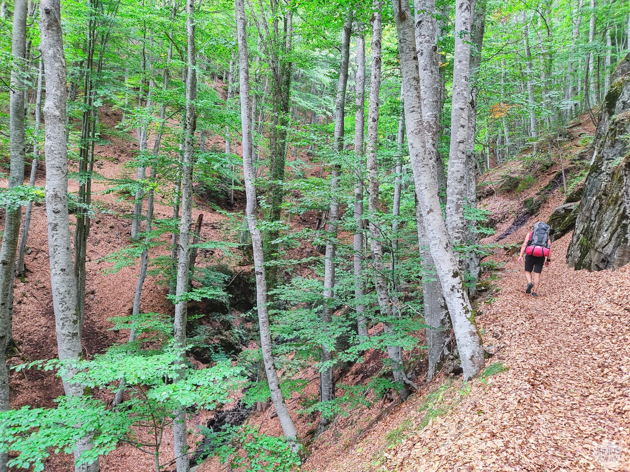
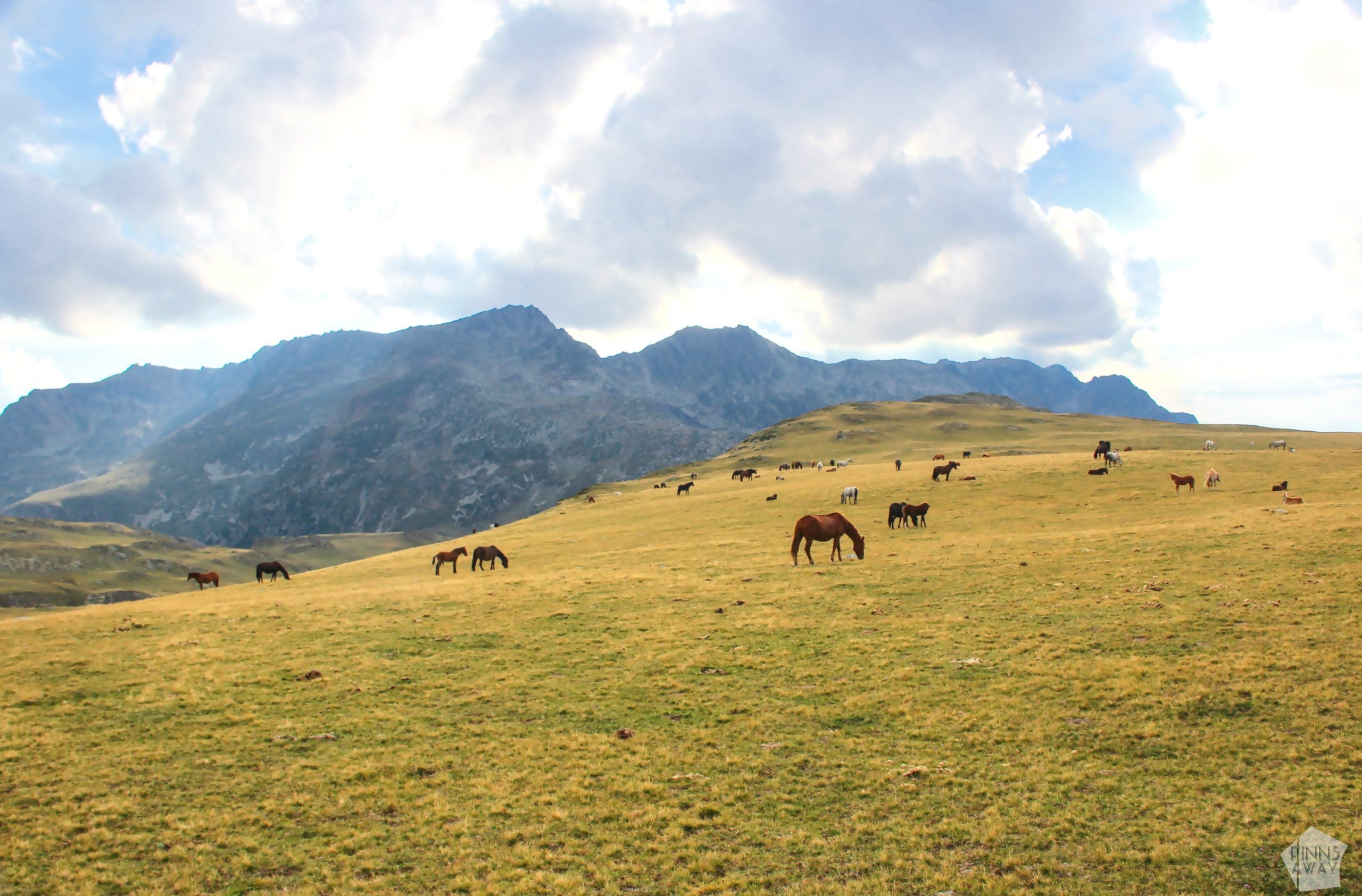
The first part of the climb was an easy upward stroll along clear paths that led through forests. After a while there were some mountain meadows with tall vegetation and some bushes, through which we had to scramble. After around two and a half hours maybe, we left the forests and meadows behind, and reached the treeless highlands with beautiful mountain views. After walking uphill for a while still, we reached the highest point of the first day, and then started the gentle descent towards the hut. The rest of the walk was an easy trek in a beautiful mountain valley with lots of grazing horses around us. We hadn’t seen many hikers on the trail from the monastery, but up in the valley there was more people.
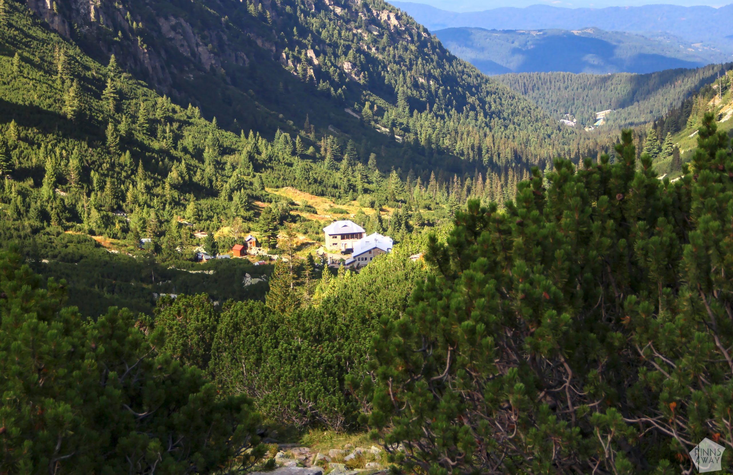
We clearly were not the only ones planning to stay the night in Ivan Vazov hut, as it was surprisingly busy, with also some bigger hiker groups coming from the Seven Rila Lakes. We managed to get two beds without reservation, but during the highest season (especially in August) it would be good idea to book beds beforehand (there is no online system to do that, but you could call). Ivan Vazov hut is a rather simple mountain accommodation with dorm rooms and water closets, but with no showers – you can utilize cold water from the stream that runs right next to the hut though. The price of a bed for a night was 30 BGN, which is roughly 15 €, in autumn 2022.
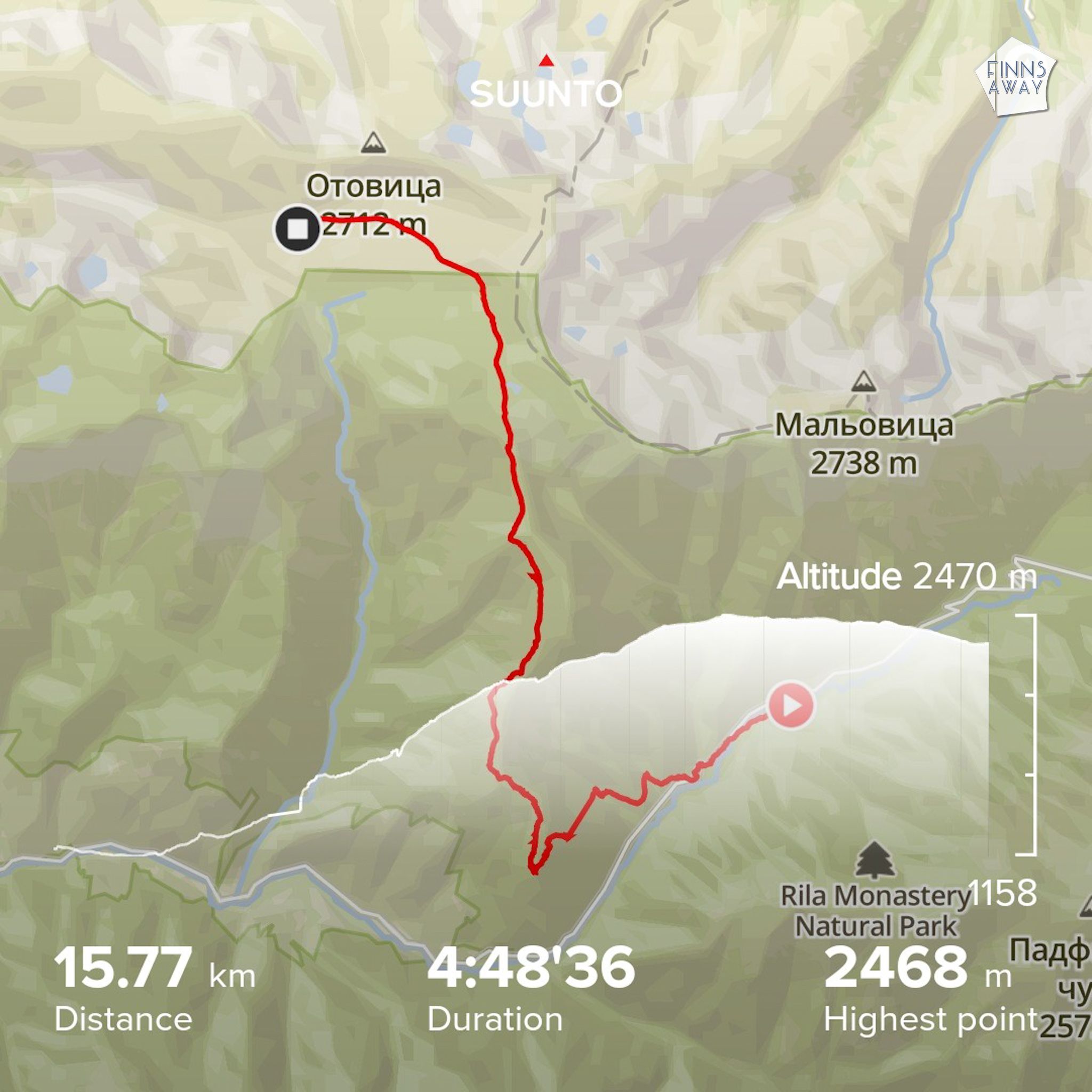
On the first afternoon we hiked 16 km with 1306 meters ascent and 209 metres descent. As it took only around 5 hours, it was a short day, but quite a climb with all the camping and cooking gear on our backs.
Day 2: From Ivan Vazov hut to Malyovitsa Peak and to Malyovitsa hut camping area
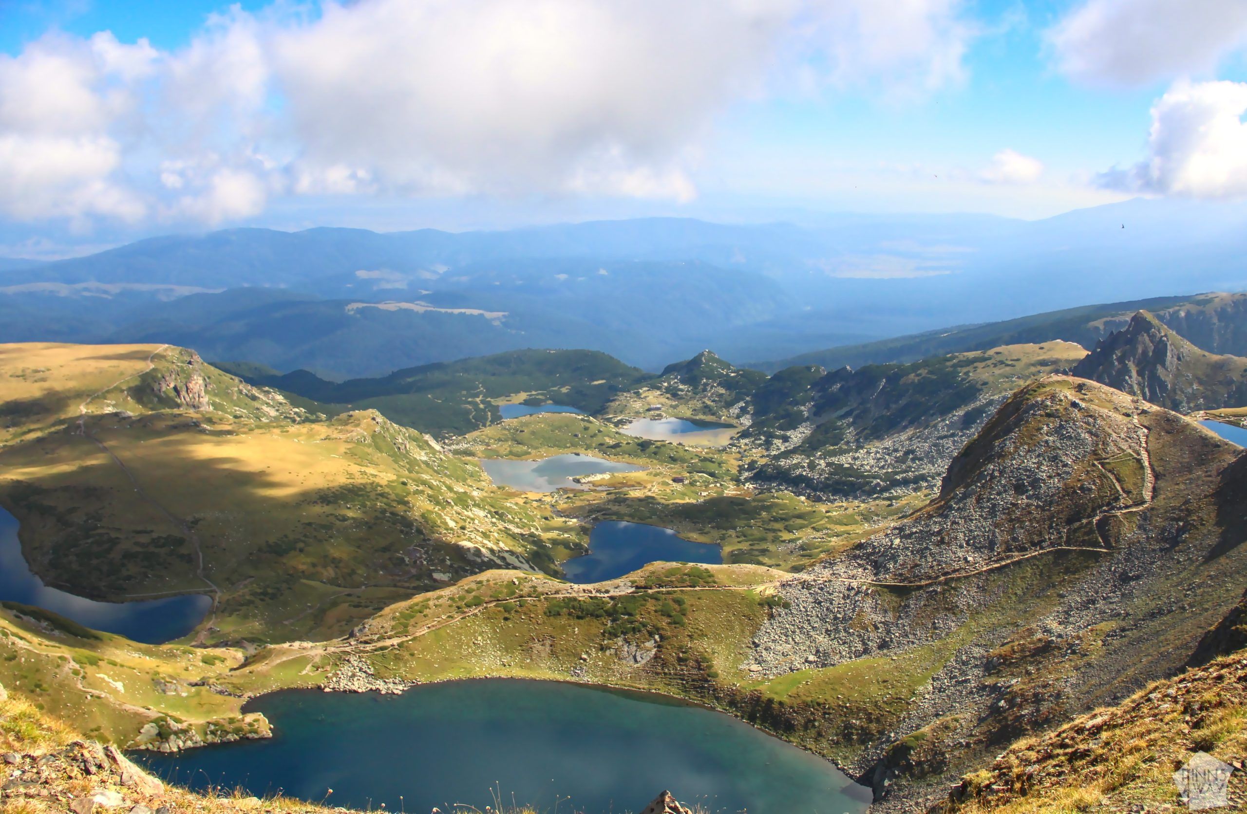
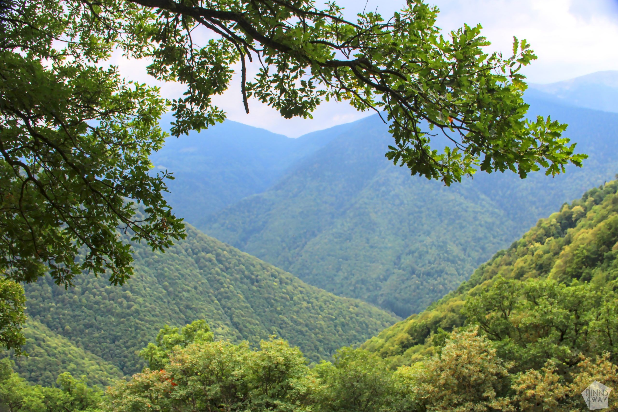
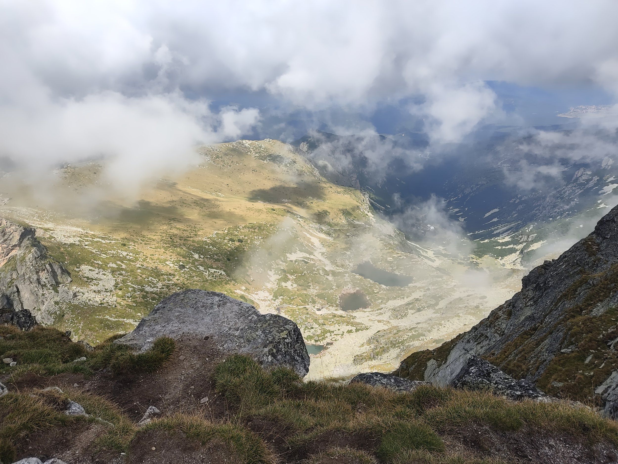
The second day of our hike in Rila Mountains in Bulgaria was amazingly scenic! We woke up to a rising sun in Ivan Vazov hut, and during the day got to admire some wonderful mountains views with several lakes, peaks and ridges. It was sunny for most of the day, but there were also a lot clouds at times. At some points we walked along a mountain ridge that acted as a weather divider – it was perfectly sunny on the other side and very cloudy, even rainy, on the other side.
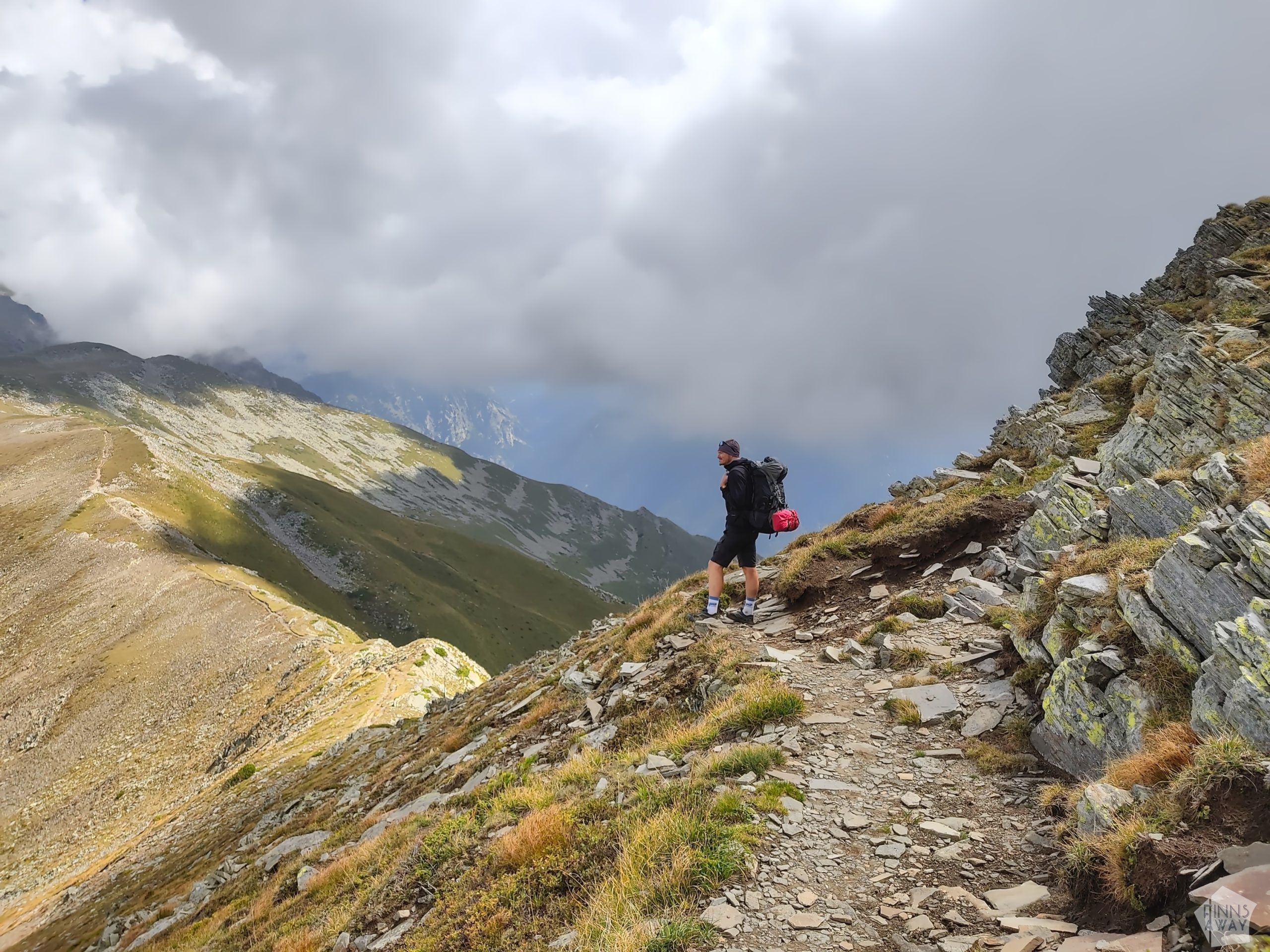
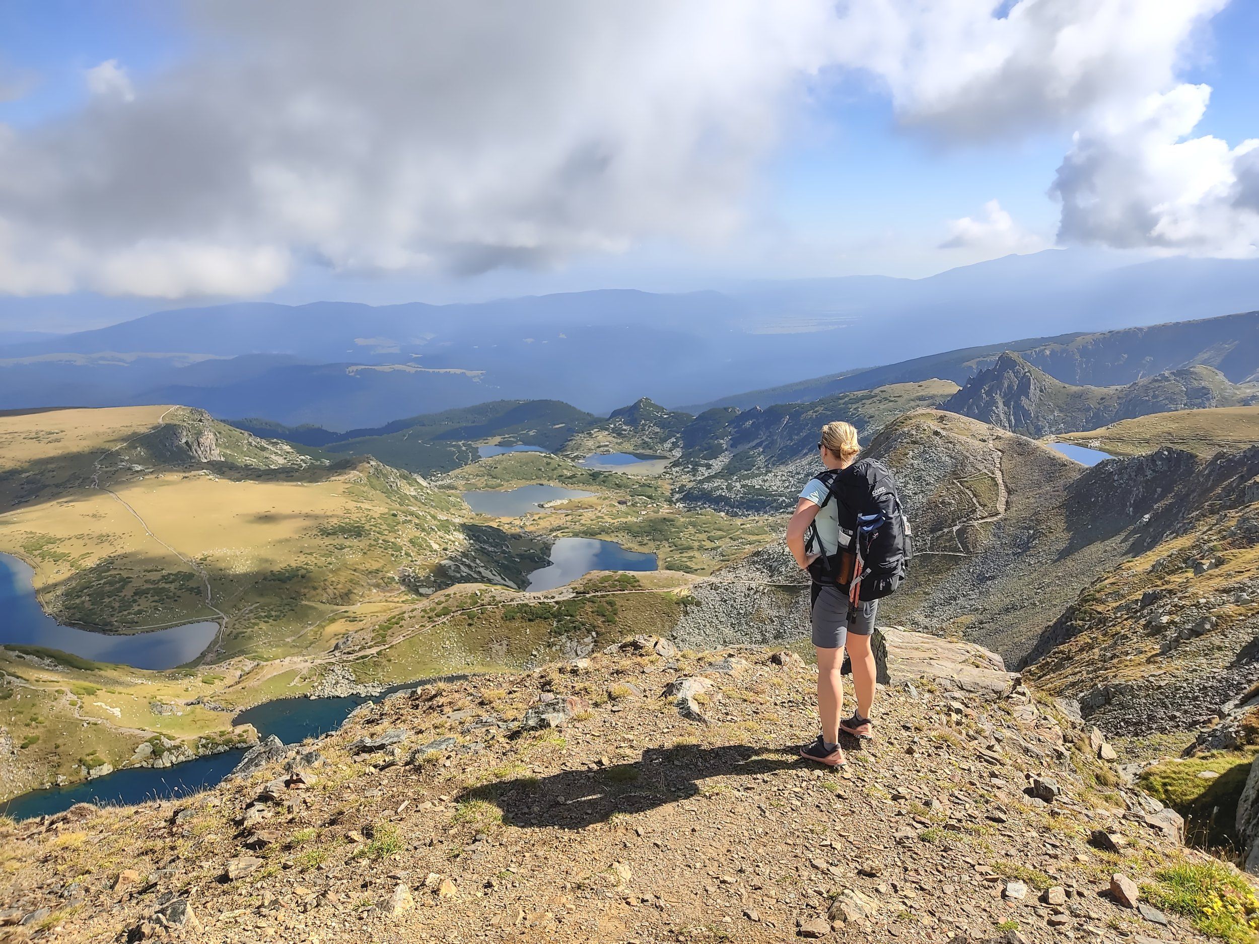
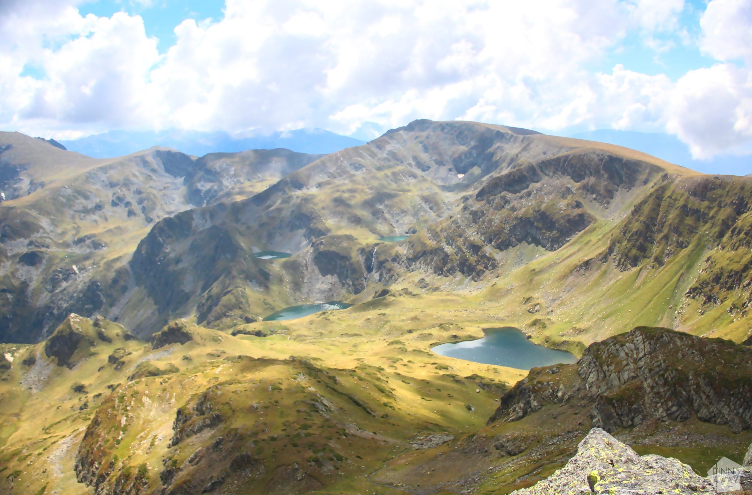
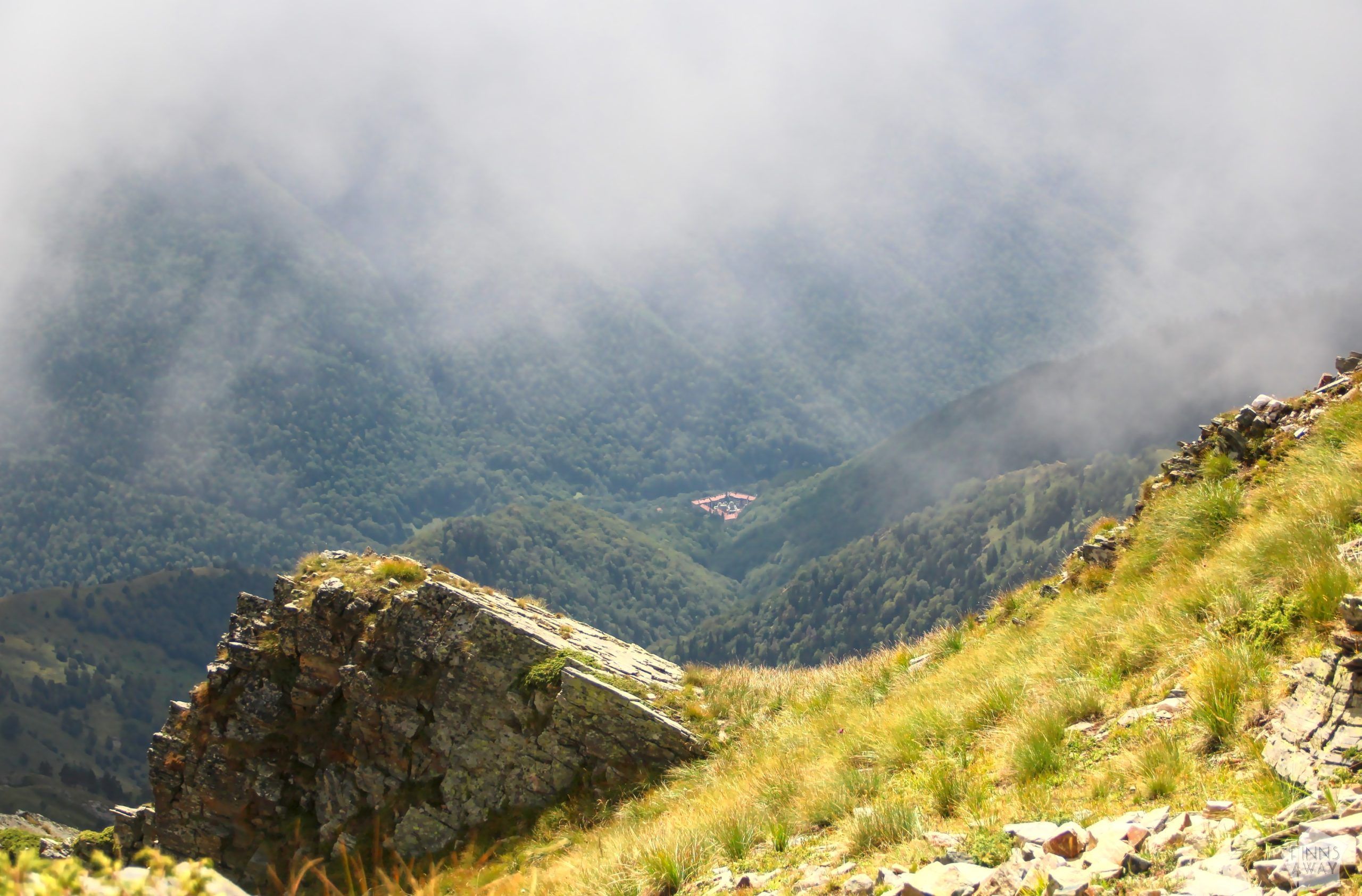
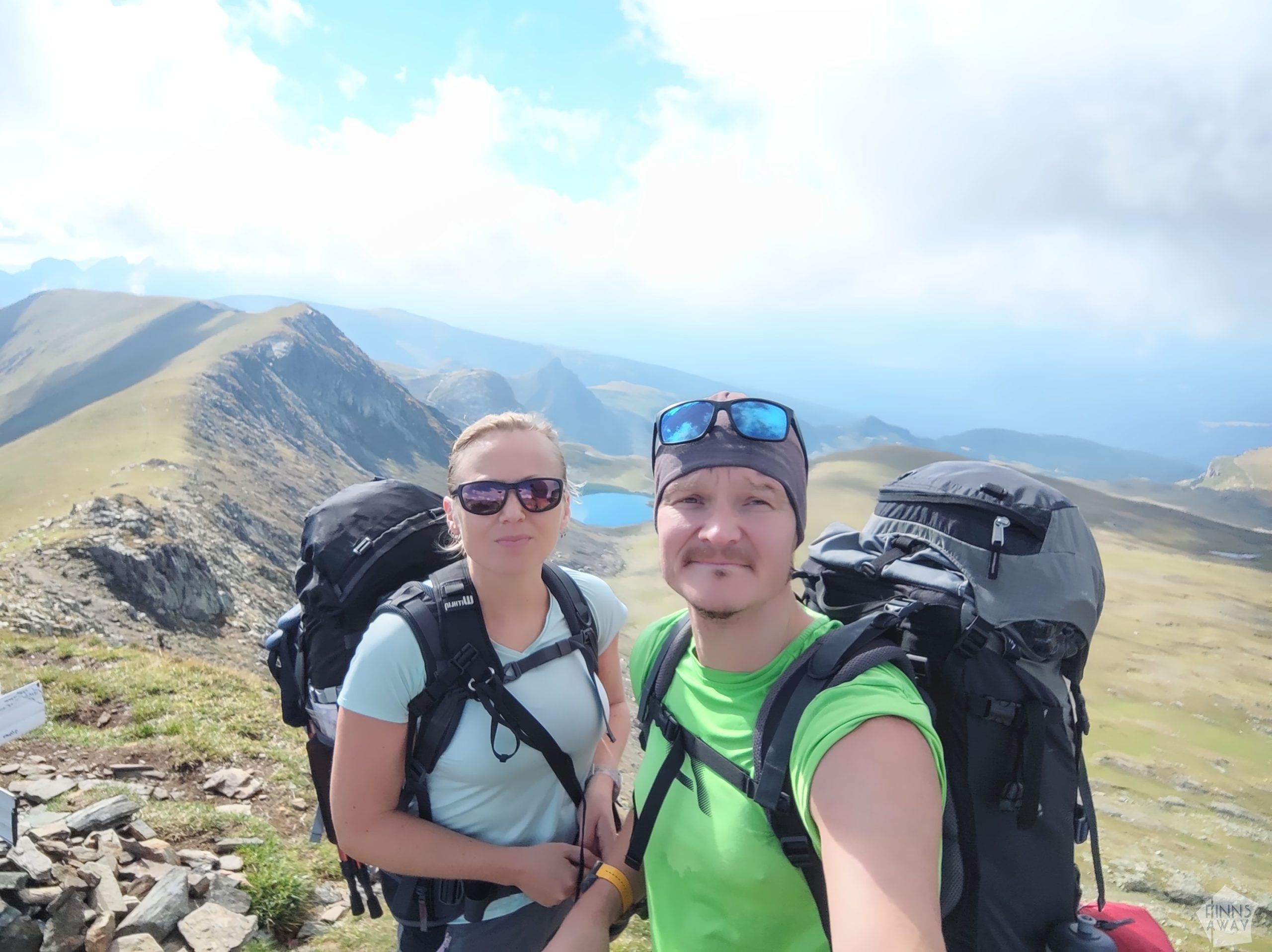
The day started with a gentle climb north, up from the valley, to a mountain ridge that we then followed east. We walked above the stunning Seven Rila Lakes, a group of glacial lakes at the elevation of 2100 to 2500 meters, and then continued towards Malyovitsa peak, passing several other beautiful lakes on the way. At one point we also got a wonderful birds-eye view to Rila Monastery down in the valley, around 1500 vertical meters below us.
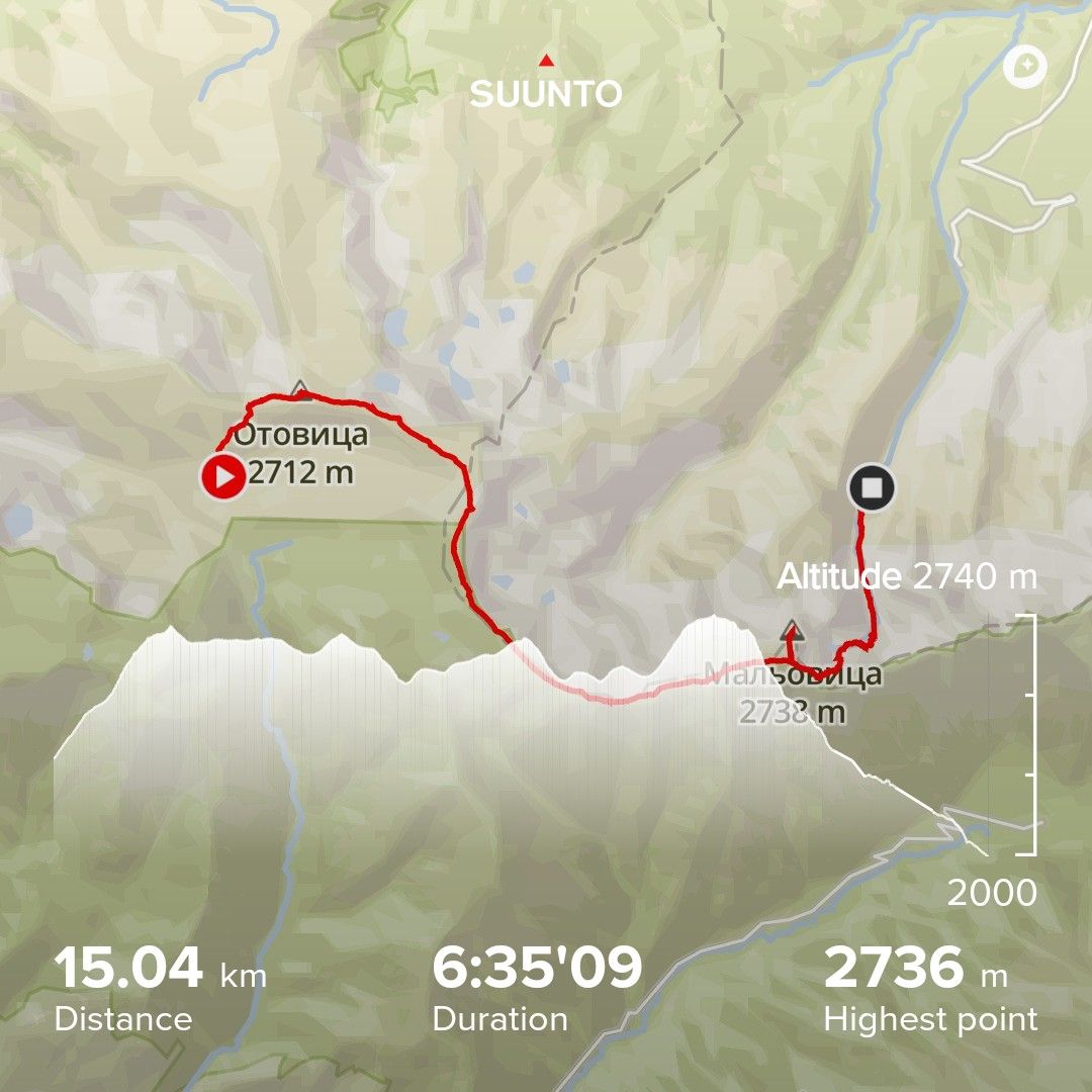
Malyovitsa Peak in 2729 meters was the highest point of our hike. It’s a beautiful and dramatic-looking peak, but unfortunately at the time or our visit it was mostly covered by clouds, so the possibilities to admire the views from the top were quite limited.
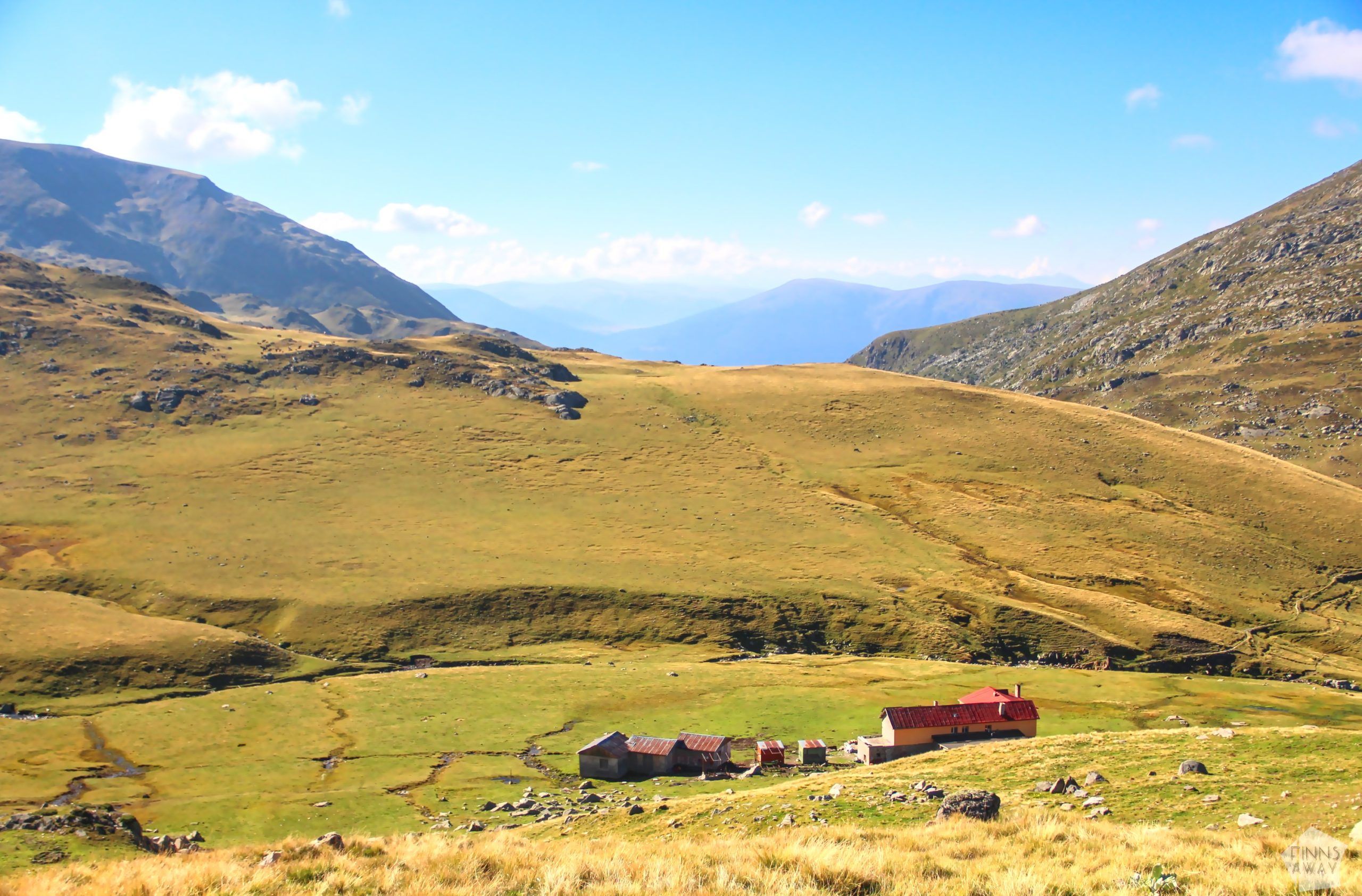
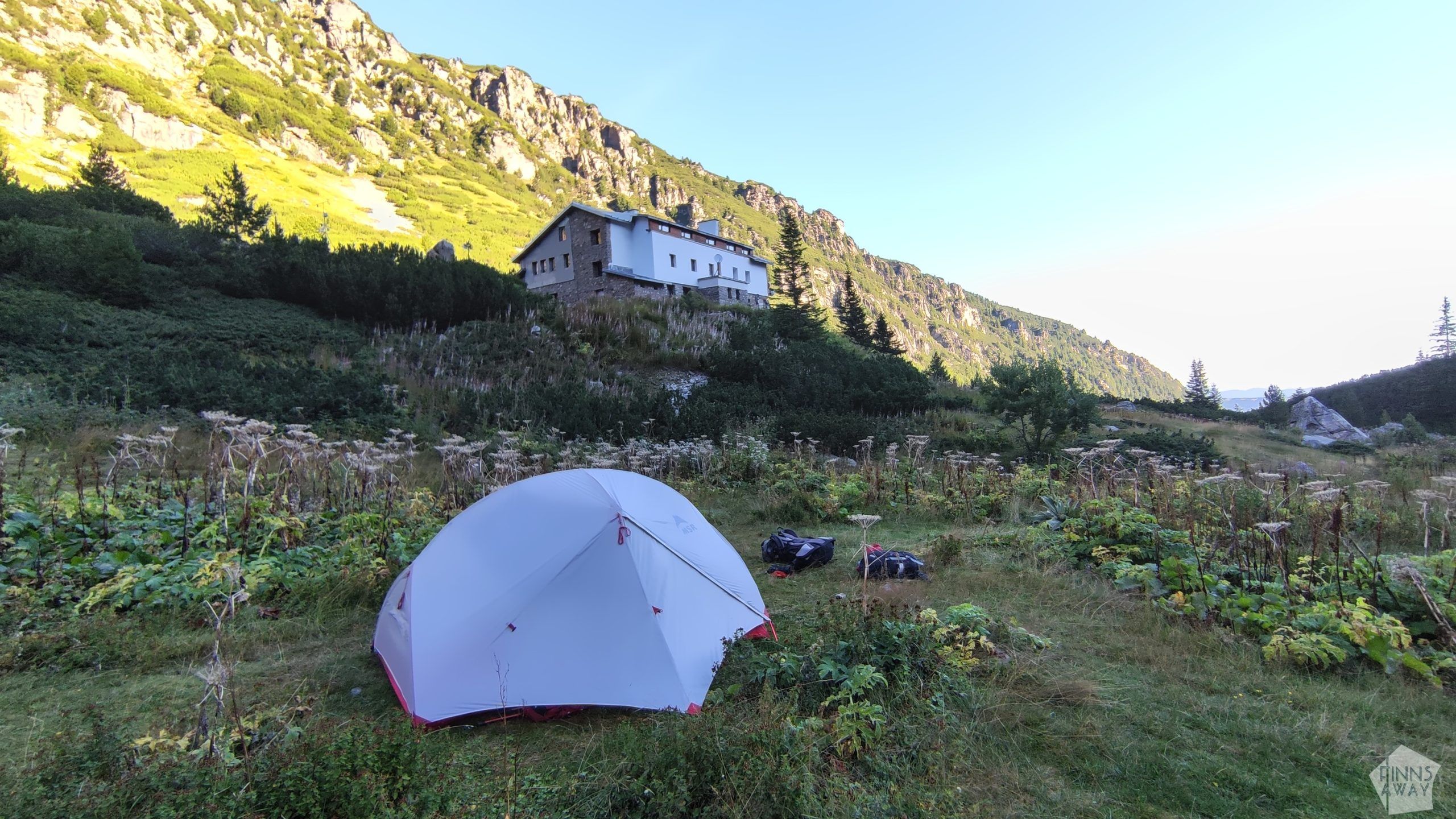
In the end of the day we descended from the peak to Malyovitsa hut and the adjacent (free) camping area. It was a slow and rocky descent, not particularly dangerous, but definitely quite challenging. On our way down the sun came back out, which was super nice after the chilly weather up on the peak and on the ridge. When finally reaching the hut, we had a couple of restorative beers and set up our tent in a scenic spot by a small river behind the hut. After cooking and eating a simple dinner, we slept through the night like babies, even if it was only around +5 C during the night.
Statistics of day two: roughly 6,5 hours of hiking, 15 km with 881 m ascent and 1151 m of descent.
Day 3: From Malyovitsa hut to Scary lake and to Rila Monastery
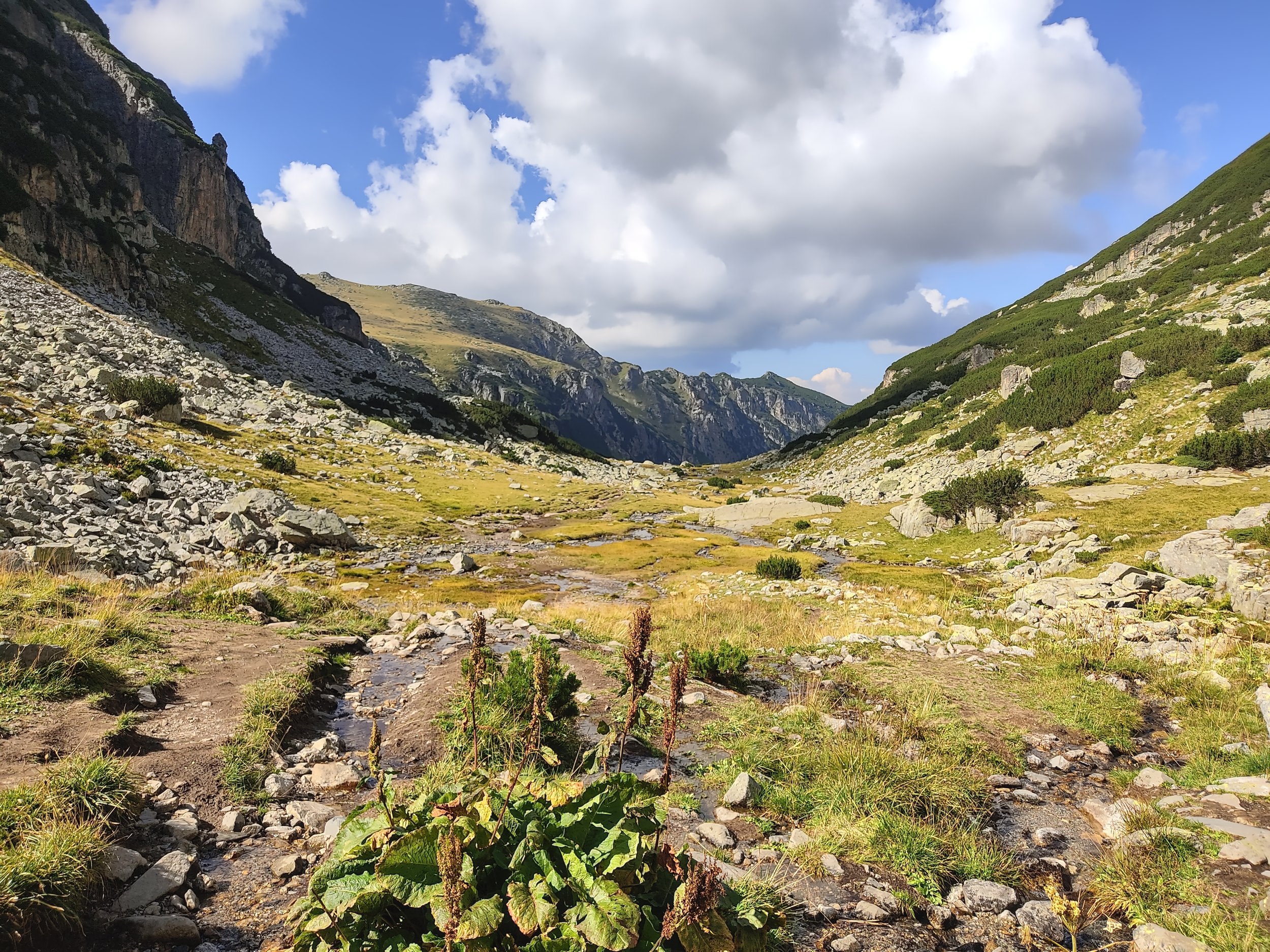
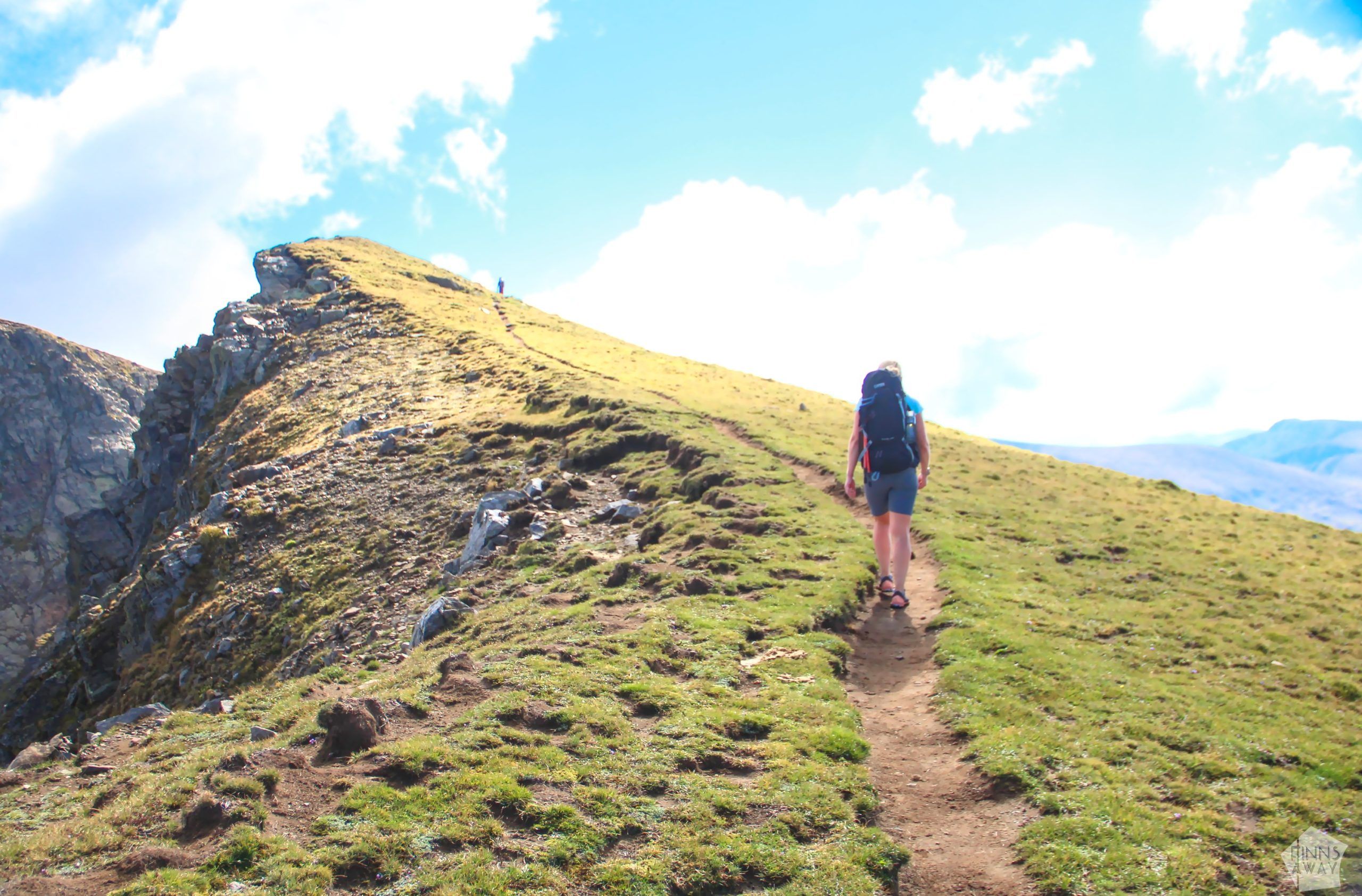
The third day of the hike offered yet more dramatic views. The morning was again beautiful and sunny. After packing our camp and having a breakfast, we headed further east from the hut, first a short walk down along the stream before a quite steep ascent up to the next ridge. Our pace was super low at first, since the path was very rocky and at times bushy too. After the first hour or so, the path finally got better and the climb was easier, and we also again started to have a very nice scenery around us.
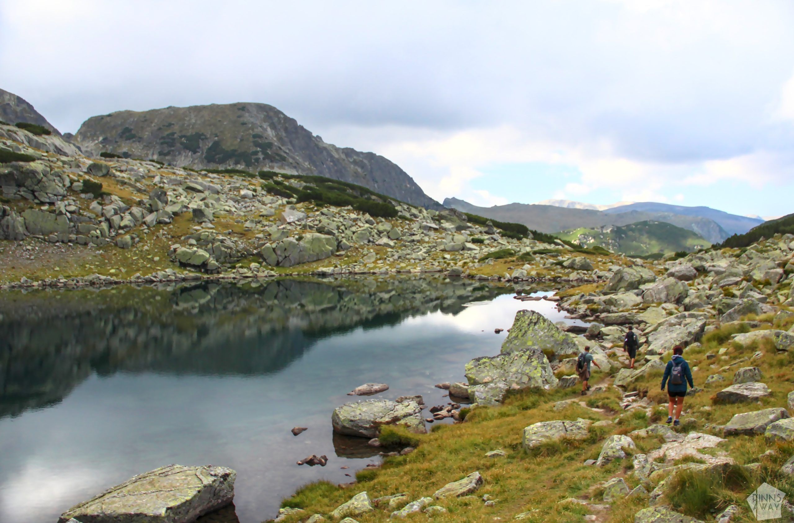
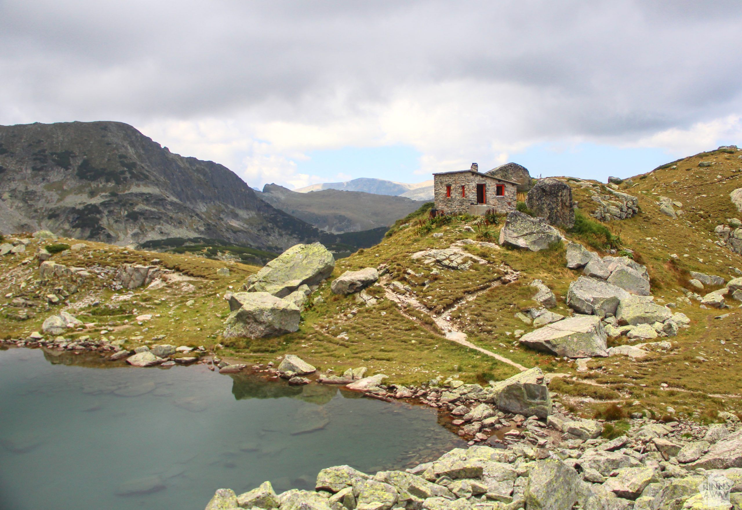
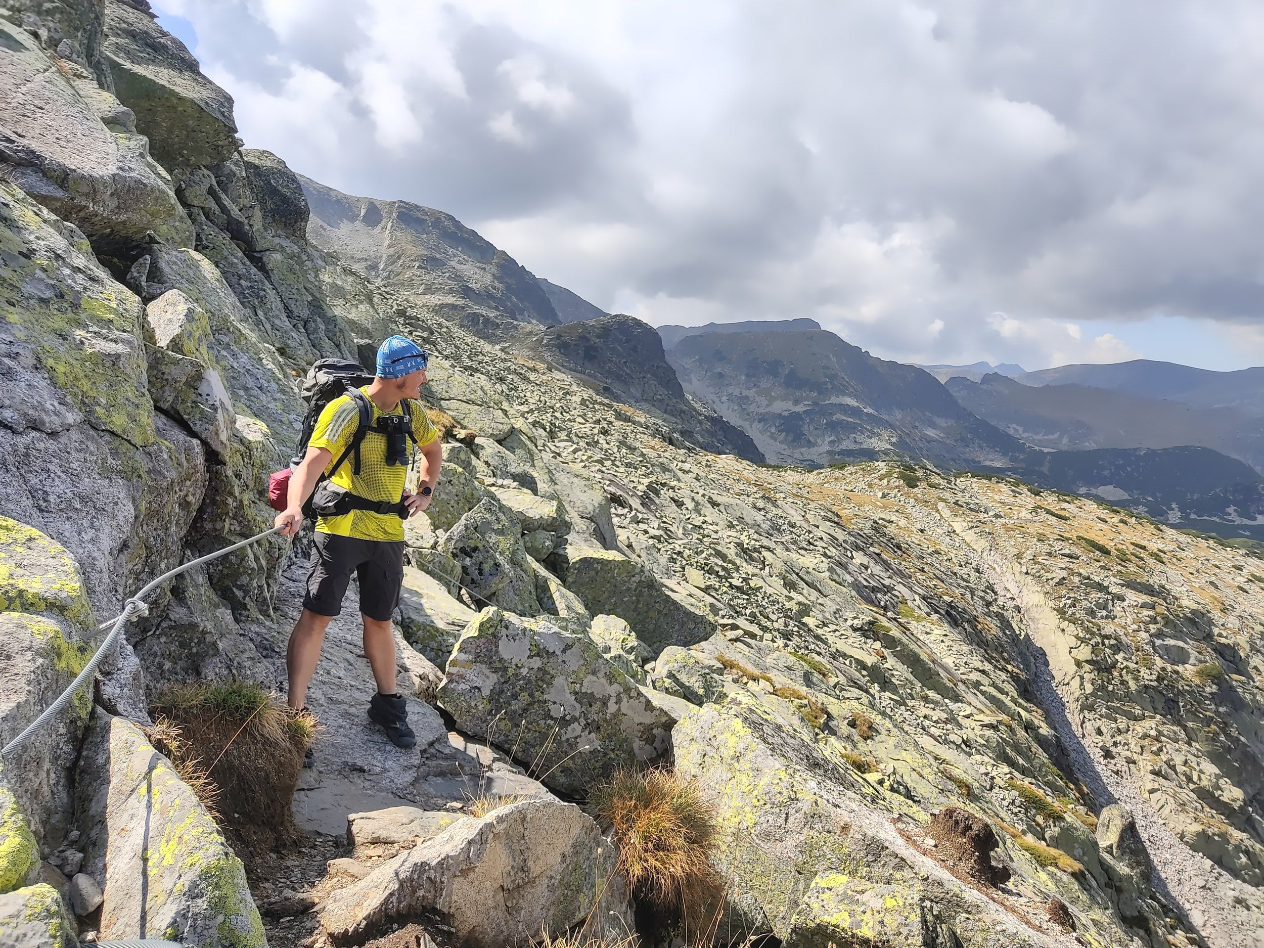
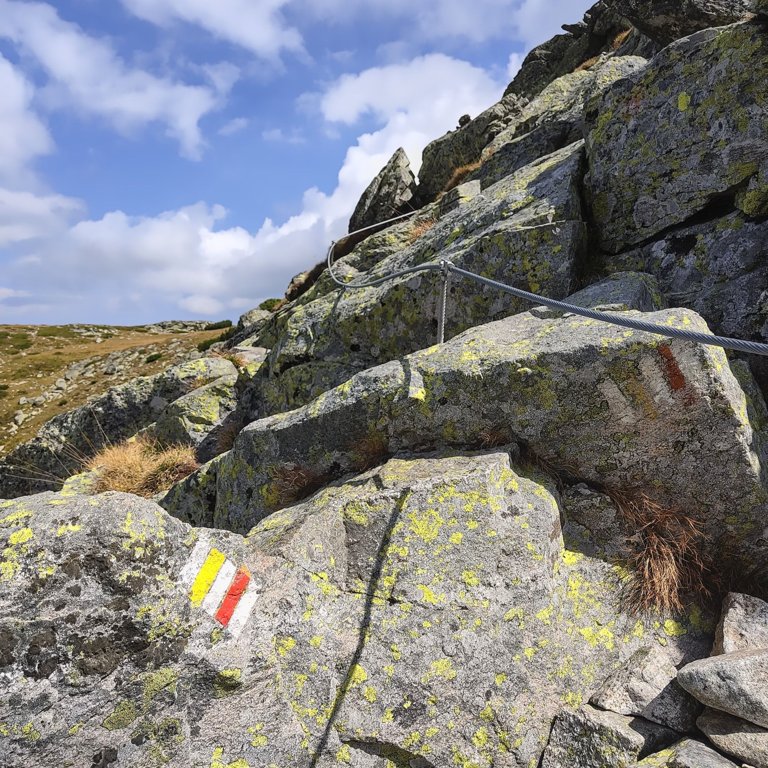
Up on the mountains we walked past some dramatic, steep cliffs and small mountain lakes. Right next to the beautiful Strashnoto Ezero lake, also known as Scary lake, there is a cute, simple stone-walled shelter, that would have been great for staying overnight (at the altitude of 2451 m). But since the day was still very young for us, we continued further east. After a gentle ascent from the shelter, there was a short, more deep section with a cable attached to the rock to help the climb (or descent if you walk in the opposite direction), but it wasn’t particularly difficult. Of course if it rains and the rocks are slippery, holding the cable helps a lot to keep the balance.
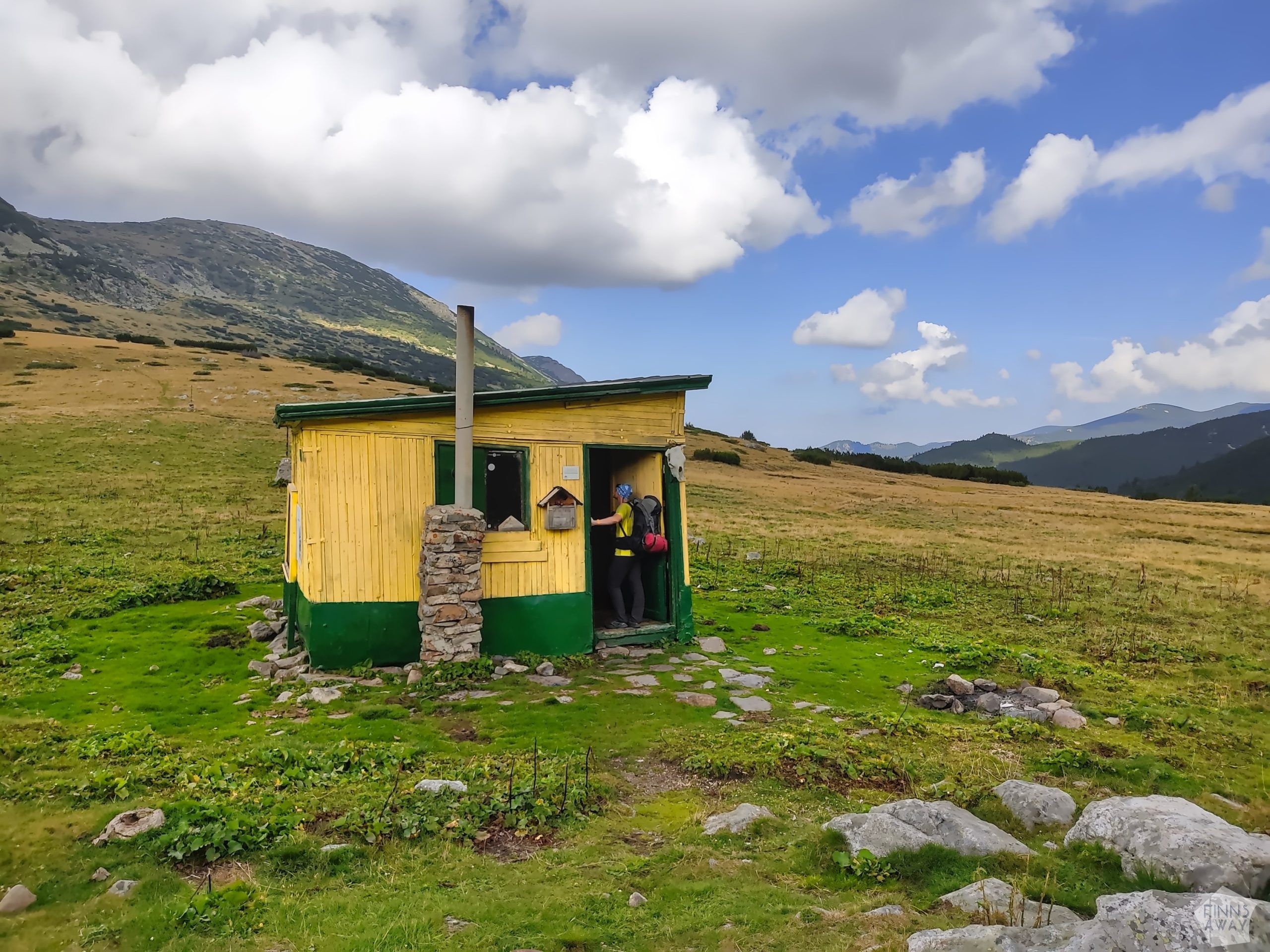
After a short snack break in the highest point of the route, we started the gradual descent to the next valley. When reaching the next shelter (Kobilino branishte) at an intersection of trails, we had to decide whether to continue hiking for still another day, making a loop to the next valley, or to head back down towards the monastery. Continuing still further east to Central Rila area was a tempting option, that would have taken us to yet more beautiful mountain lakes, but then again, getting to know that area better would have required several more days. As we were already running low with food, we decided to head back down right away, and to make another longer hike some day to explore the Central Rila region.
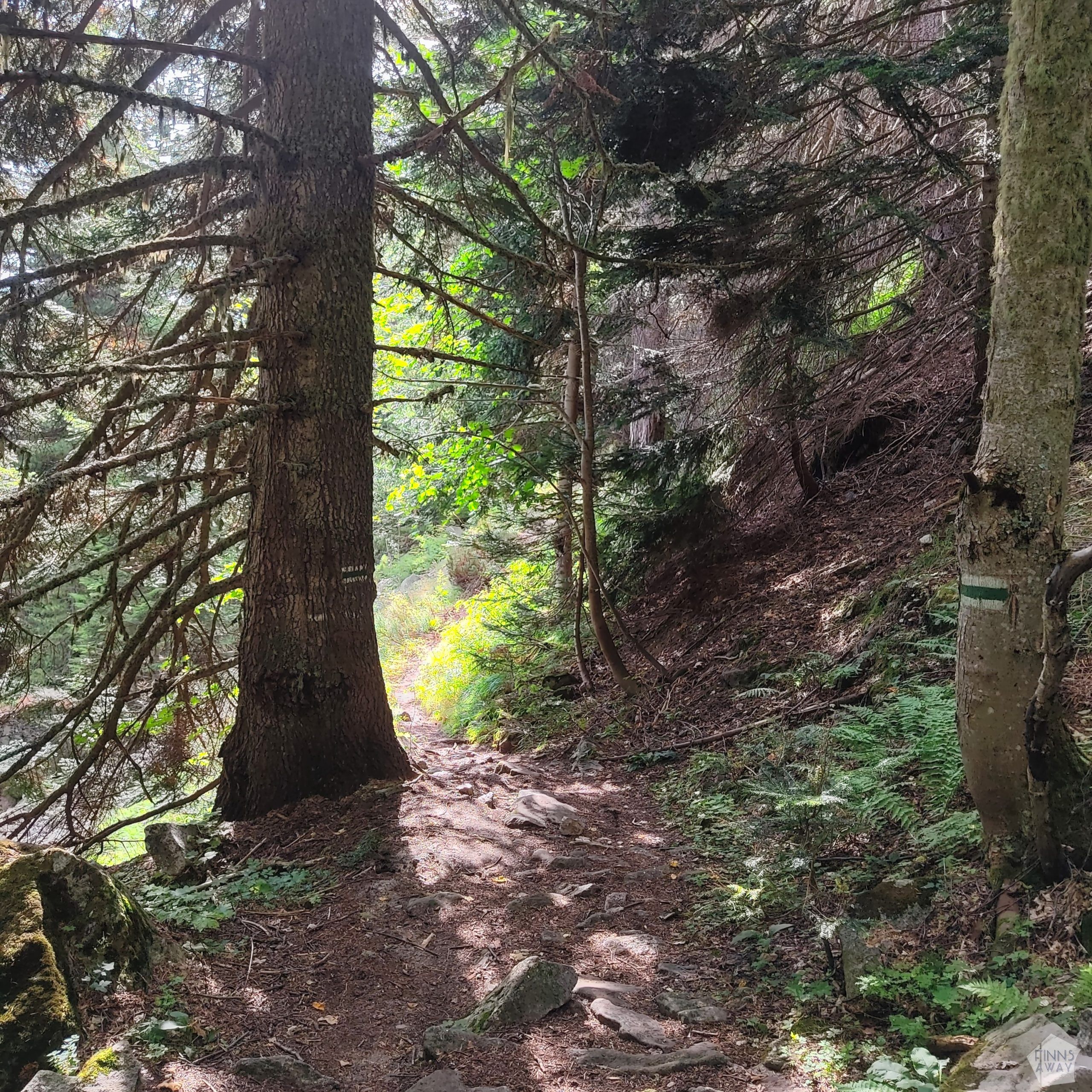
The descent towards Rila Monastery and Camping Bor, where we had left our car, was a long one, with a lot of vertical meters. Luckily there were no steep sections, so it was rather gentle for the knees to walk down. Those who have hiked great elevations surely know, that the ascents can be hard, but it’s the descents that really hurt. The trail down in the valley was first quite challenging, as it was muddy, rocky and at times bushy, but after we reached the Sukhoto lake, the path got wider. The rest of the trek was mostly an easy walk down through some handsome, old forests.
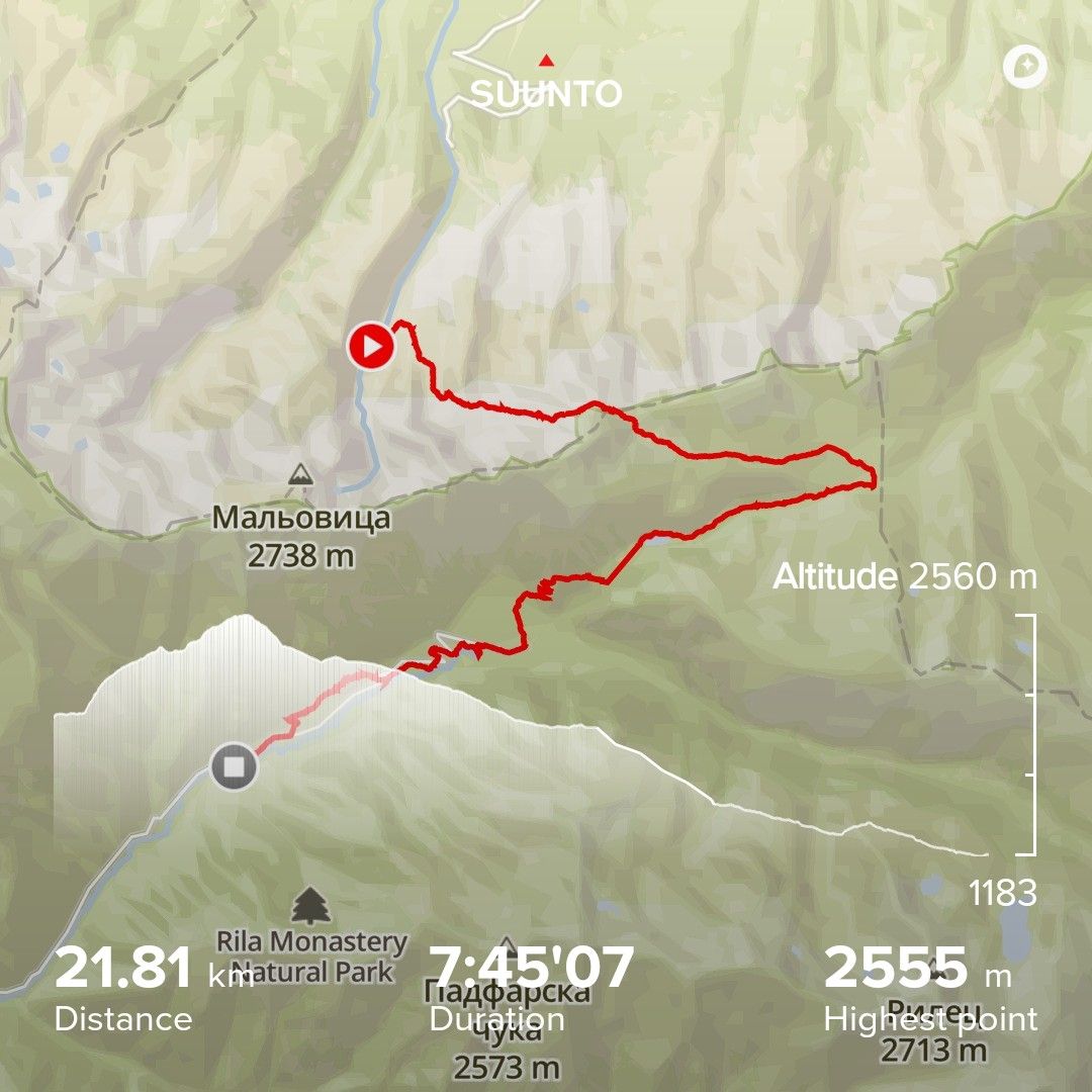
Statistics of day three: almost 8 hours of hiking, 22 km with 814 meters ascent and 1658 metres of descent. The total length of this three-days circular hike was 53 km, with a bit over 3000 meters of vertical in total.
Tips for planning your hike and for packing
When to go to Rila Mountains? As Rila is a relatively high mountain area, there are very different seasons. The winter is cold and snowy, and during the winter and early spring Rila primarily is a skiing destination. There are some marked winter walking routes too (we did a snowy hike to the Seven Rila Lakes from the northern side of the mountain range back in late October 2017), but we would say that the summer months and early autumn are the best time for hiking. Many of the ski lifts are in operation daily during the summer, but not during the shoulder seasons between the skiing season and the summer season (i.e. spring and late autumn), so if you’d like to utilize them to take you closer to the mountain peaks, check the schedules in advance.
The marked trails in Rila Mountains are easy to follow, but the terrain is varied, from soft meadows to rocky sections and from forests to rugged mountain ridges and peaks. Many trekkers hike with sturdy boots, but others, like us, prefer lighter footwear. We did this hike, like all the hikes and trail runs recently, wearing trail running shoes*. Running shoes are light, dry quickly and do not cause blisters (at least if you are used to wearing them). Regarding clothing, we mostly hiked in T-shirts and shorts, but also needed to use long-sleeves and wind-proof jackets at some points of the hike. Don’t forget a hat either, to protect both from cold and sun, and it’s recommended to also pack light gloves, as it really can be chilly and windy, especially on the higher peaks and ridges.
For planning the overnight stays, you should notice that, even if relatively well tolerated, wild camping is not officially allowed in Rila National Park, or in Bulgaria in general. In the national park there are some dedicated areas for camping though, usually close to the huts, like the Malyovitsa hut camping area that we used. The network of huts and unmanned shelters is quite comprehensive, so multi-day hikes can be done utilizing them. However, when hiking in the mountains, it’s always wise to have something to sleep in / under in case of an emergency, even if you plan to stay in huts and shelters. Our camping gear included a light-weight tent, sleeping pads and warm sleeping bags, as well as a camping stove, dishes, matches, and a torch. We carried some light-weight food supplies with us, as well as some snacks. The huts offer breakfast and other meals (have some cash with you), and you can fill in your water bottles of course too.
For navigating, we had a paper map as well as an offline map app (maps.me) in our phones, and we also used Suunto GPS watches with pre-planned routes to follow. As the paths are marked, having a GPS device is not necessary, but you should of course have some sort of a map with you. Rila paper maps can be bought in many stores in Bulgaria (if I remember correctly, we bought ours from Kaufland in Sofia). If a self-guided hike is not your cup of tea, there are also several guided hiking tours available in Rila area, many of them with transportation from Sofia.
*This post was written in collaboration with bikester.fi, a European online store with a comprehensive selection of gear for cycling and other sports.
Pin this post to save it for later
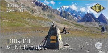
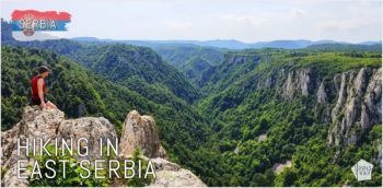
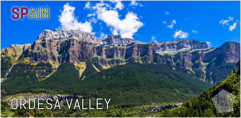
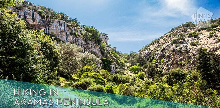
More posts about hiking in Europe
Our resources
and Discounts
and Discounts