FinnsAway blog – nomad life and travel adventures
Sorteny Valley Nature Park
 Sorteny Valley is situated in northern part of Andorra, close to the small town of Ordino. The Sorteny Valley Nature Park, established in 1999, covers an area of 1080 ha, and the reserve has high level of biodiversity. There are over 800 different species of flora, out of which around 70 species endemic to the Pyrenees Mountains. There is also a botanical garden, with information about the biodiversity and flora of the Sorteny reserve, and around 300 species of flora growing in the gardens. The fauna of the reserve includes mammals like chamois, deer, marmots and stoats, and there are dozens of species of birds and butterflies.
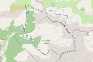
The valley is surrounded with scenic mountain peaks. Marked hiking paths crisscross the valley and surrounding peaks, leading for example on top of la Serrera (2913 m) and l’Estanyo (2915 m) peaks, and to Estanyo Lake at the altitude of 2339 meters. Views down to the valley from the mountains and the lake are very photogenic. The main river, Sorteny, runs through the valley, and reaches the altitude of 2680 meters, which makes it the highest flowing river in Andorra. Hiking independently in Sorteny Valley Nature Park is easy, but there are also guided hiking tours available. The nature center of the park is situated in the village of La Cortinada, and there is a small information booth in the parking lot of the park.
Three peaks hike – our route
 This itinerary is for a very long day hike, with distance of roughly 20 km, elevation gain over 1500 meters and walking time of 9 to 10 hours or even more if your pace is low. It’s a challenging loop, not only because of the length and amount of ascent and descent, but because of partly rough terrain, lack of clear path in French side, and some steep slopes that require using your hands when climbing up. It’s neither the trail for inexperienced hikers or kids, nor for those with fear of heights, as it requires good physical health, and because part of the trail runs along a mountain ridge with quite steep drop on both sides. Despite these warning words, it’s a great hike and doesn’t require any special equipment. As not the whole trail is well marked, you’ll need some kind of trail map to find your way. We used maps.me offline map application, that shows all the paths and your location. You could also download our gps-track and use it with a sports watch to follow exactly the same route.
To Serrera Peak via Rialb Valley
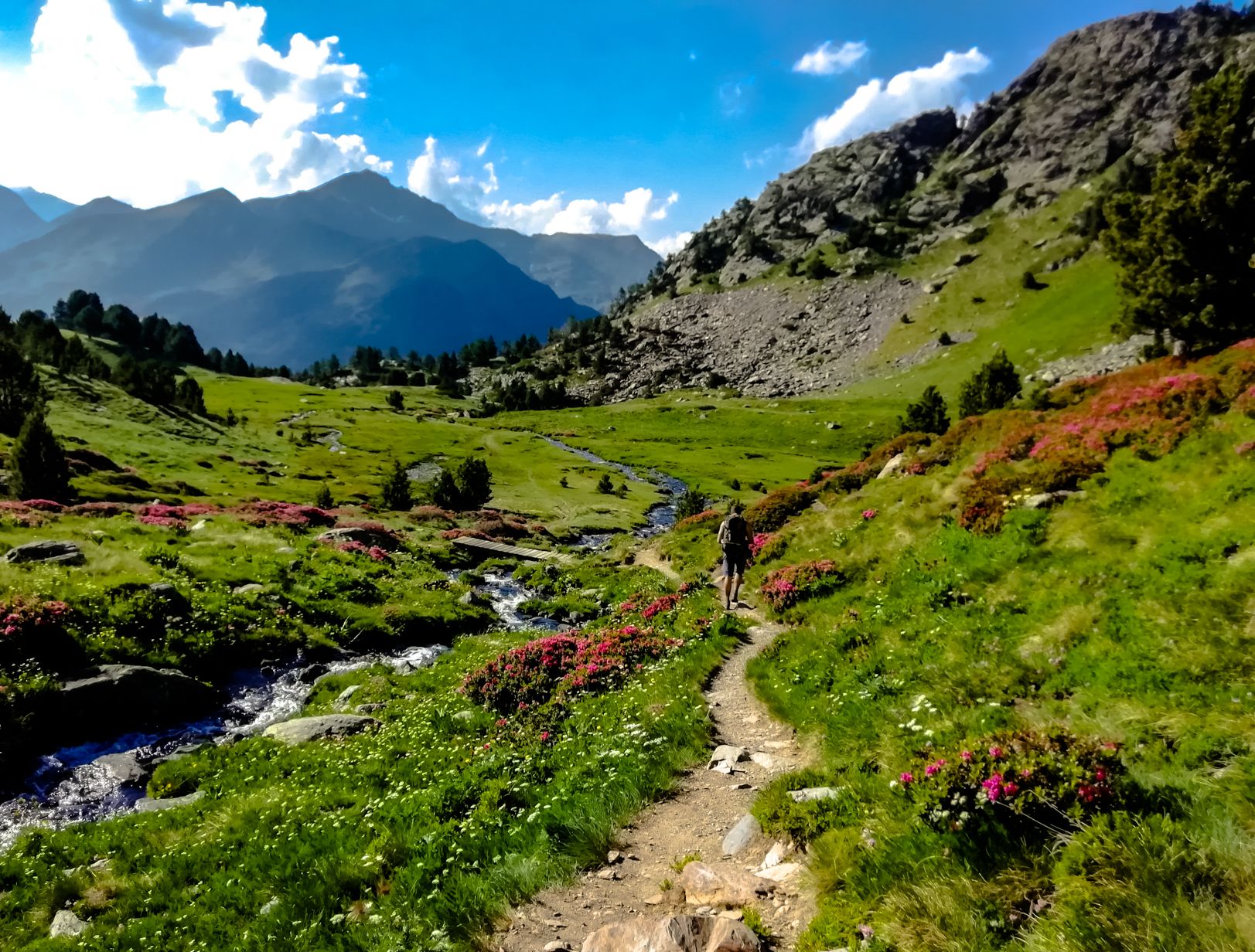
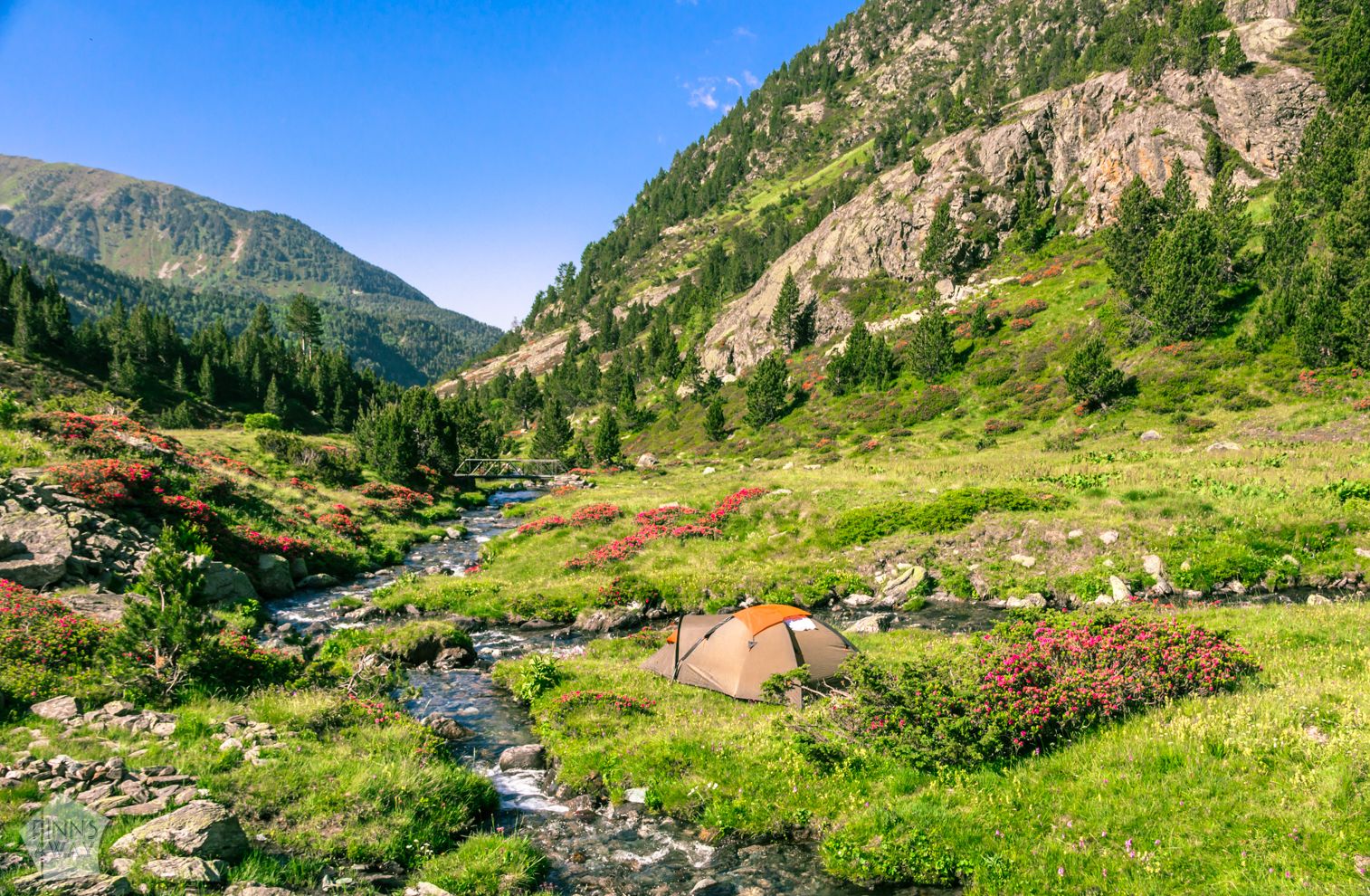
Begin the hike from the parking lot of the nature park, from the trail end on the northern side of it, by a picnic area and a small stream, River Rialb. First part of the hike is an easy 2 km stroll slightly uphill along the river in beautiful Rialb Valley, to the Refugi Rialb shelter. The path is easy to follow and marked. If you plan on staying overnight and are on budget, this is the perfect spot, as you can stay for free in the shelter or in a tent outside of it if the shelter is full. The shelter is very simple; no toilet or shower, but bunk beds and a fireplace. You can leave your camping stuff in the shelter for the hiking day, and only carry a daypack.
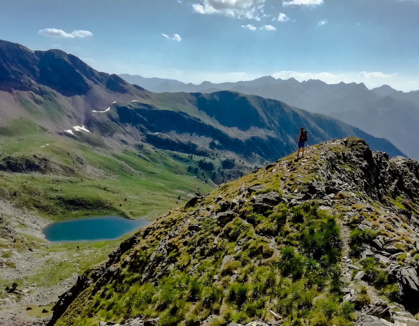
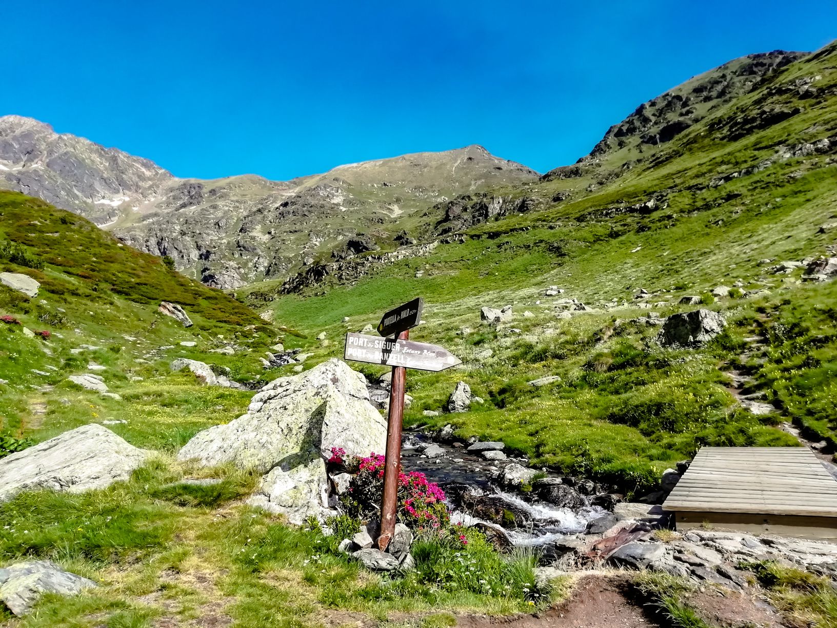 The second part of the hike takes you above river valleys and mountain lakes, over the border of France, up on top of a mountain ridge and to Serrera Peak. Continue following the path northeast from the shelter, towards Port de Siguer and the Estany Blau (Blue Lake). You’ll follow the river first, and then cross it along a small wooden bridge. After around 10 minutes from the shelter, there is another crossroads, where you should choose the path towards east, Port de Banyel and Estany Soulanet. The path is easy to follow at first, and after 2 kilometers takes you up over a mountain pass, which also marks the border with France.
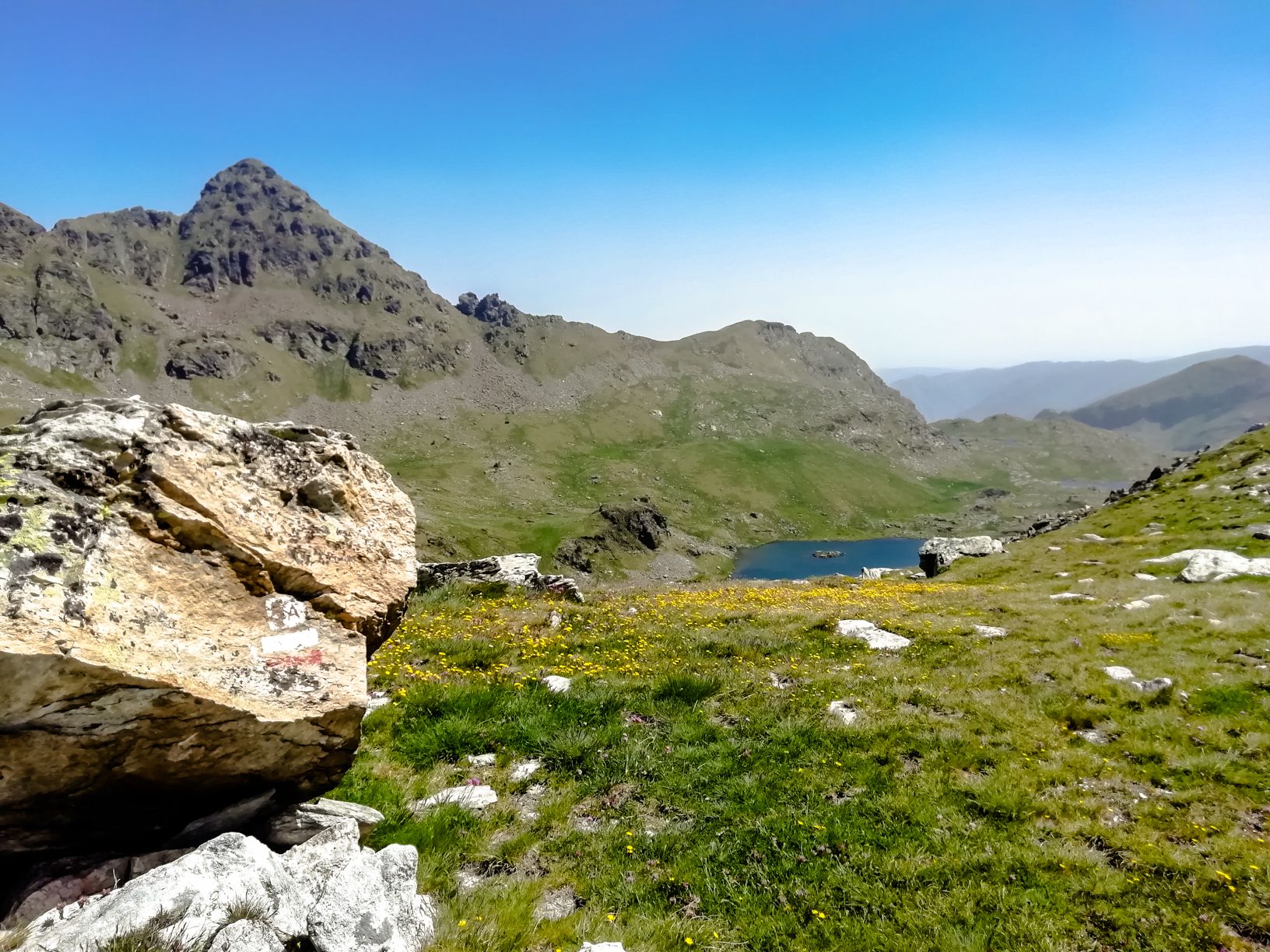 When you reach the pass, there is a great view towards Lake Soulanet on French side. From the pass the route continues east on French side, descending a bit the first two kilometers before turning back south towards the next mountain pass. This part of the trail was quite hard to follow, as the path is not marked, and obviously not very popular and thus not well-worn. It goes over some rocky sections and across small streams. In early July there was still some snow left, but the terrain was mostly dry, just walk around the snow banks. The ascent to the mountain pass and border is steep and rocky, and we found our own way as we couldn’t really find any kind of path up. When climbing up, you can see the Serrera Peak (2913 m) on your left side, and when up in the pass, just follow the ridge up on top of the mountain. The views are great. The main paths to Serrera Peak are on the southern side of the mountain, so this route up is really off-the-beaten-path.
From Serrera Peak to Cabaneta Peak
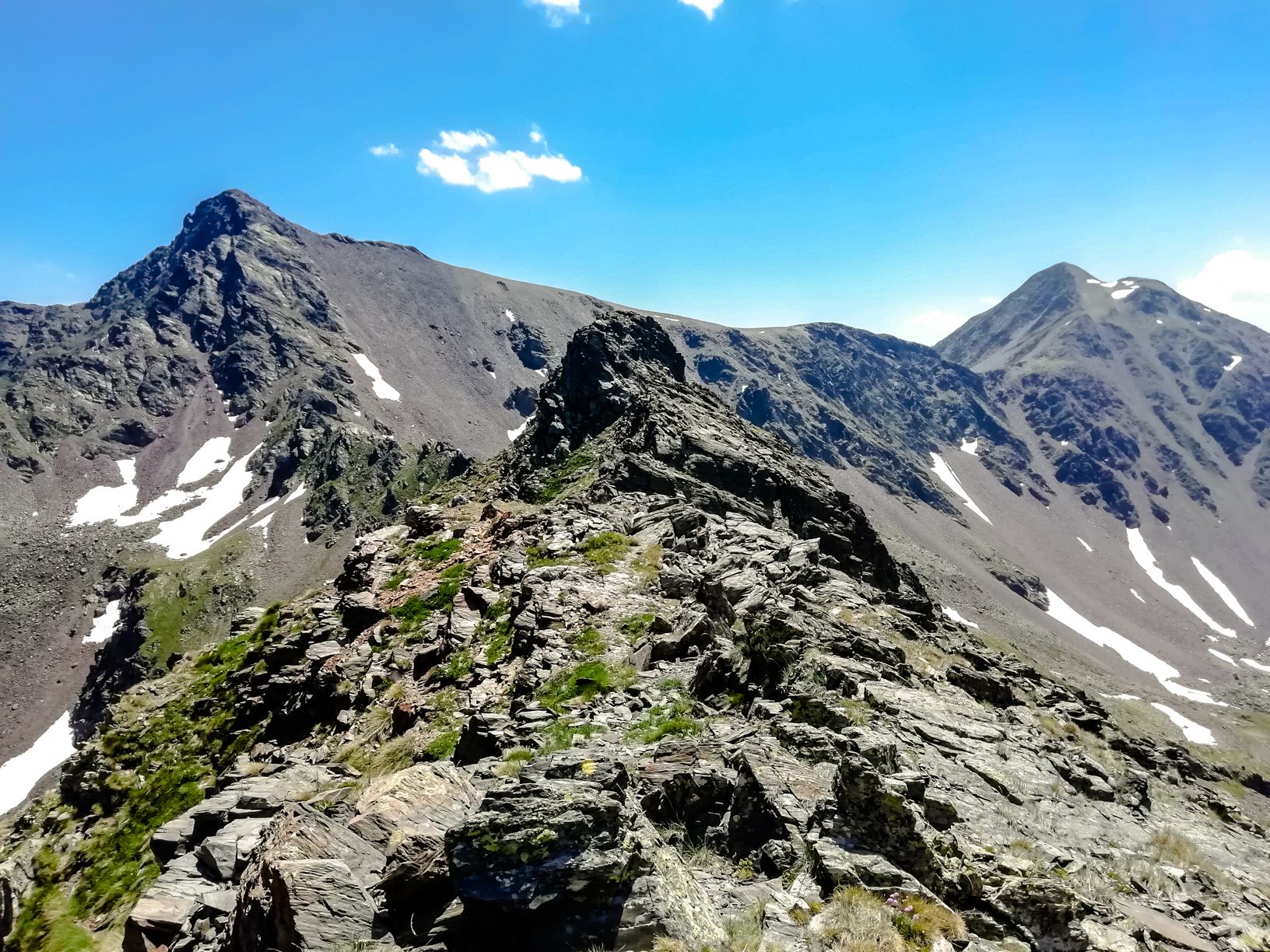 From Serrera Peak it’s possible to take the main trail southwest, and head straight down to Sorteny Valley and back to the parking lot via staffed Refugi Borda de Sorteny. However, the three peaks hike continues southeast along a gorgeous mountain ridge between la Serrera and la Cabaneta. This path is marked and mostly easy to follow, but the ridge is very rocky and there is a steep drop in both sides. From the ridge you can see both La Cabaneta (the peak on left in the picture above) and L’Estanyo (on right) in front of you. We made a short detour to a some kind of a shelter on the eastern side of the ridge to check if there is a water source, but there isn’t any, and the building is not in a good shape, so don’t bother. The final ascent on top of La Cabaneta (2862 m) is steep and comes with loose soil, so the climb is not very pleasant. We decided not to follow the path in the end, but stayed close the big rocks instead, using them to support the difficult climb on top. When on the summit of La Cabaneta, the climbing part is over, and the views are again wonderful.
From Cabaneta to L’Estanyo and back down to the valley
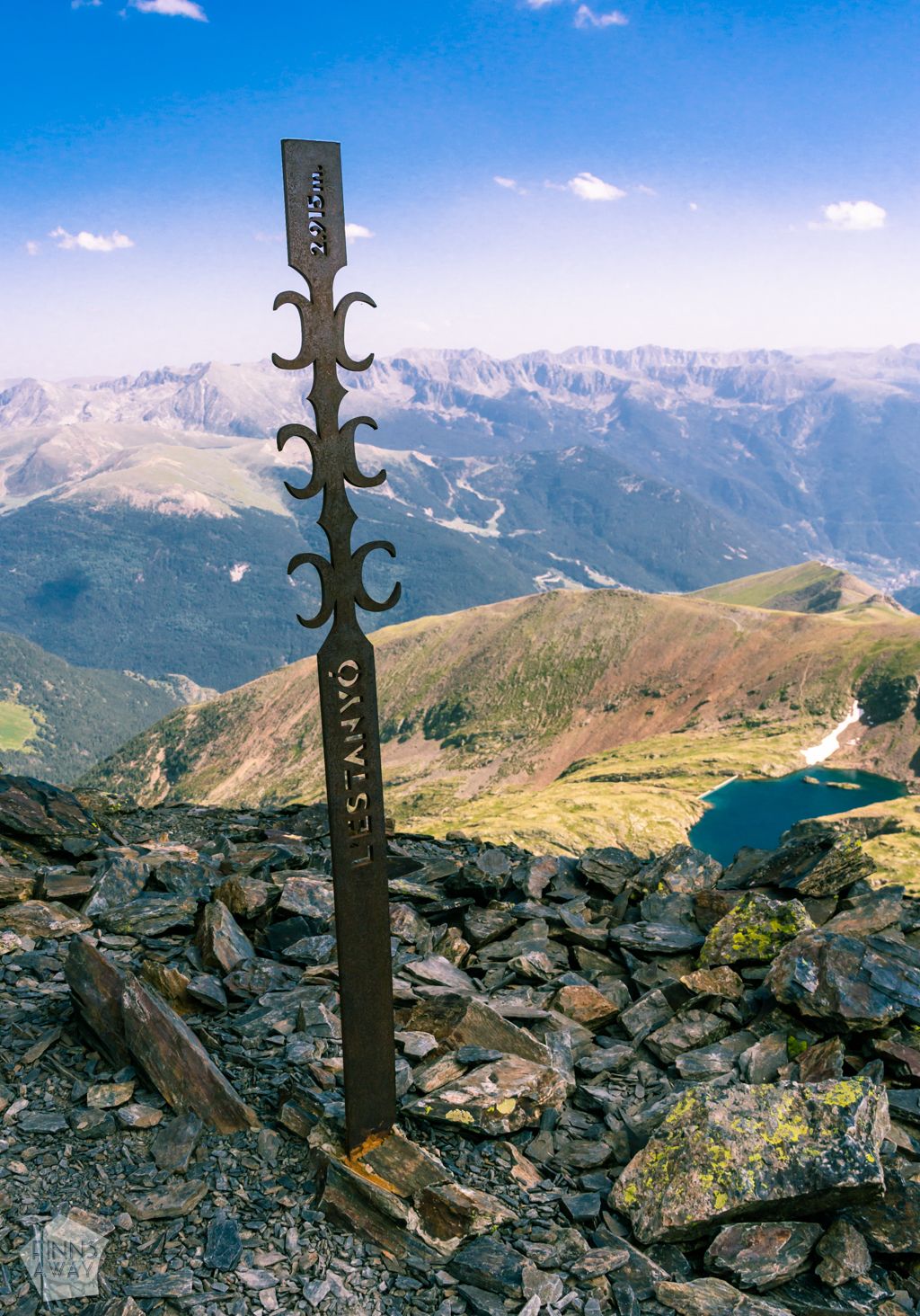 Reaching the third and highest peak of the hike, L’Estanyo (2915 m, the second highest peak of Andorra) from La Cabaneta is an easy stroll of 1,5 kilometers, first descending along a mountain ridge and then walking up on top of the peak. On the way and from the summit of L’Estanyo you can admire Estany Gran de la Vall del Riu lake in south and Sorteny Valley in west. Then it’s time for a long and scenic descent down to Sorteny Valley via Lake Estanyo. After the lake the path follows Estanyo River through the green and flowery valley, and the views are absolutely charming. Before reaching Sorteny River and Refugi Borda de Sorteny, the path leads through a small forest. In the refuge we rewarded ourselves with a small beer before continuing the final few kilometers towards River Rialb and our camp. If you started from the parking lot, the shortest route is the main path southwest from the refuge.
Staying overnight in Sorteny Valley
 There are dozens of traditional, simple mountain huts in the mountains of Andorra. They are great for getting shelter in case the weather changes, but also for staying overnight. Camping is allowed outside the huts, when they are full. There are also several bigger, staffed huts with hostel-style accommodation and meals for sale. Outside the nature parks, the mountain towns have some guesthouses, and there are nine official camping sites around the country.
In Sorteny Valley Nature Park, there is a staffed hut called Refugi Borda de Sorteny, situated in the valley at the elevation of 1995 meters, just under a 30 minute walk from the visitor center and the parking lot. This big, newly renovated hut has several heated dormitories, showers, a restaurant and a big terrace with views to the mountains. It’s open during the summer from June 1st to September 30th and in the winter season. Staying overnight costs 17 € (13 for kids), a breakfast 10 € and a dinner another 20 €. Regarding the free shelters, there is a small shelter called Refugi Rialb (6 beds) by the River Rialb, two kilometers north of the nature park parking area.
For our trek, we decided to stay two nights in the park, to be able to make a long day hike. We also didn’t want to pay for the accommodation, so we headed to the Refugi Rialb, carrying our own tent with us. The shelter was full, but we were happy to set up the tent in a small island in the river, not far away from the shelter.