FinnsAway blog – nomad life and travel adventures
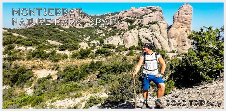
 Montserrat is a multi-peak mountain range in Catalonia, near Barcelona, famous for its’ monasteries and oddly-shaped rock formations. In this post we write about hiking in Montserrat Nature Park and share the route of our day hike up on the mountain, with a downloadable route map and a picture gallery. We shortly introduce the trails that lead up to the Montserrat Monastery from the foot of the mountain, as well as the trails that run up on top of the mountain in Montserrat Nature Park. To learn more about visiting Montserrat and Santa Maria de Montserrat Abbey monastery, check out our travel guide post about Montserrat.
Table of contest:
About Montserrat Nature Park
Hiking up from the foot of the mountain
Hiking on top of Montserrat and to Sant Jeroni Peak
Our day hike in Montserrat Nature Park
What to pack for your hike
Where to stay
Montserrat Nature Park
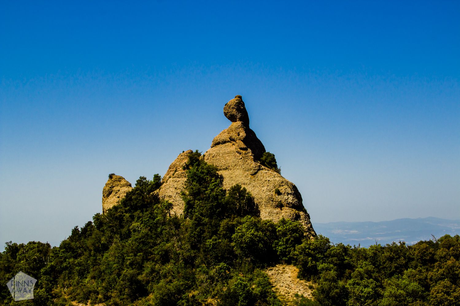 The geology and nature of Montserrat Mountain Range are unusual and to preserve it, a nature park was established in 1987. In Mesozoic era, over 100 million years ago, the mountain top was under water, part of a delta area, and the sediments in the present day rock pillars were in the bottom of a river and lake. After the lake and river dried, the area was exposed to erosion, and over a long period of time, the mountain with several peaks formed. Not just the geology us uncommon, but also the climate up in the mountain is unique, with different micro-climates. Wildlife of the park includes mammal like squirrels, boars and goats, wide range of different birds, bats and geckos. Vegetation varies from oak forests to small flowery meadows, and altogether there are over 1250 species of plants.
Hiking trails in Montserrat
Hiking up to the monastery from the foot of the mountain
 The Montserrat Monastery up on the mountain can be reached by a car or bus along the road, by a rack train from Monistrol de Montserrat village, or by a cable car from Aeri de Montserrat station. It’s also very well possible to hike up, and there are a couple of easily accessible trails. Both the trails described below are marked and should be easy to follow even without a map. However, these trails are not that developed or popular as the main trails on top of the mountain, and come with over 600 meters of partly steep ascent. Trails have been described as difficult by some hikers, so maybe they are not for very inexperienced hikers or ones with knee problems. An offline map app like maps.me is very useful for following your location and checking where the alternative paths lead.
From Monistrol de Montserrat village, there is a walking trail called Cami de les Aigues (GR5 / GR96) leading up to the monastery. If you come by train to Monistrol de Montserrat train station, cross the river along Pont Gotic bridge, and walk to the village. You’ll find the trail end from along the main road Carrer de la Trinitad – from Place de la Font Gran in the village, walk up the Carrer de la Font stairs that lead to the main road, and the trail is on the opposite side of the road. After less than 1 km of hiking, there is a fork, and you can choose from two different paths. GR5 (Cami de les Aigues) is the left work, a bit longer but more even trail. The other option is trail called Drecera dels Tres Quarts (GR 96), which is a bit shorter but with steeper ascent. Whichever trail you choose, it leads up to the Benedict Abbey quite steadily, but with some steeper sections and stairs. Walking time from the trail end to the monastery is around 1,5 hours.
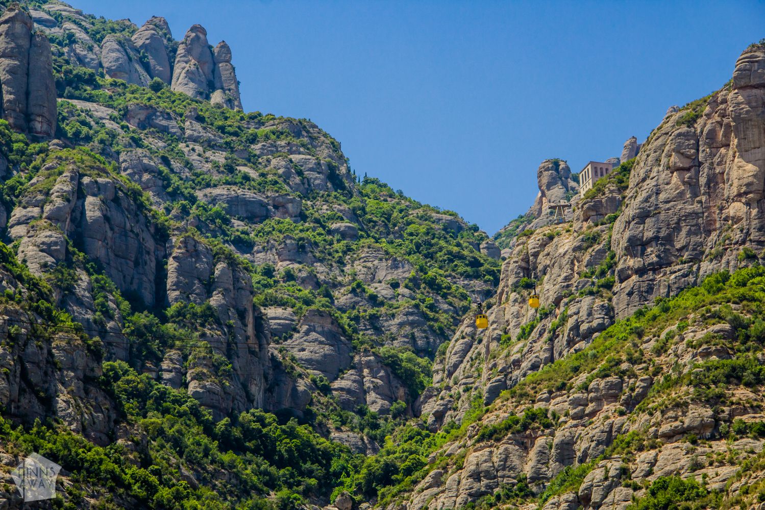
The other hiking trail up begins from Aeri de Montserrat cable car station. The first part of this hike is to cross the bridge, turn right and follow the main road for a few minutes, until there is a trail end on the opposite side of the road. This trail up takes around 1 hour 15 minutes, and the ascent is a bit over 600 meters. This path comes together with the GR 5 trail form Montserrat village after 1 km of walking. We didn’t try these trails up ourselves, as we visited Montserrat along a road trip, so we had our own wheels. We drove up closer to the monastery by car and started our hike from there. It was a mistake though to leave the car on the side of the road for night, more about that later in a separate post.
Hiking on top of Montserrat and to Sant Jeroni Peak
 When you have reached the Benedictine Abbey Santa Maria de Montserrat, take some time to visit the monastery, the handsome basilica and possibly the museums. The main hiking trails up to the mountain summit area leave from the monastery, but there are also some alternative, less popular trails from elsewhere around the mountain top, from along the BP-1103 road. You can get a map of the main trails from the tourist office in Montserrat Monastery, but maps.me app is very useful for planning you route using the alternative paths also.
For those after only short and easy walks, there are some short walking routes around the monastery, taking you to pilgrim sites and past religious monuments and sculptures. One popular option is to walk down to Santa Cova chapel, along Cami de la Sta. Cova trail. Part of the descent, or way back up, can be covered via Santa Cova funicular, but at the time of writing, the funicular was under renovation, and planned to be opened again in spring 2020.
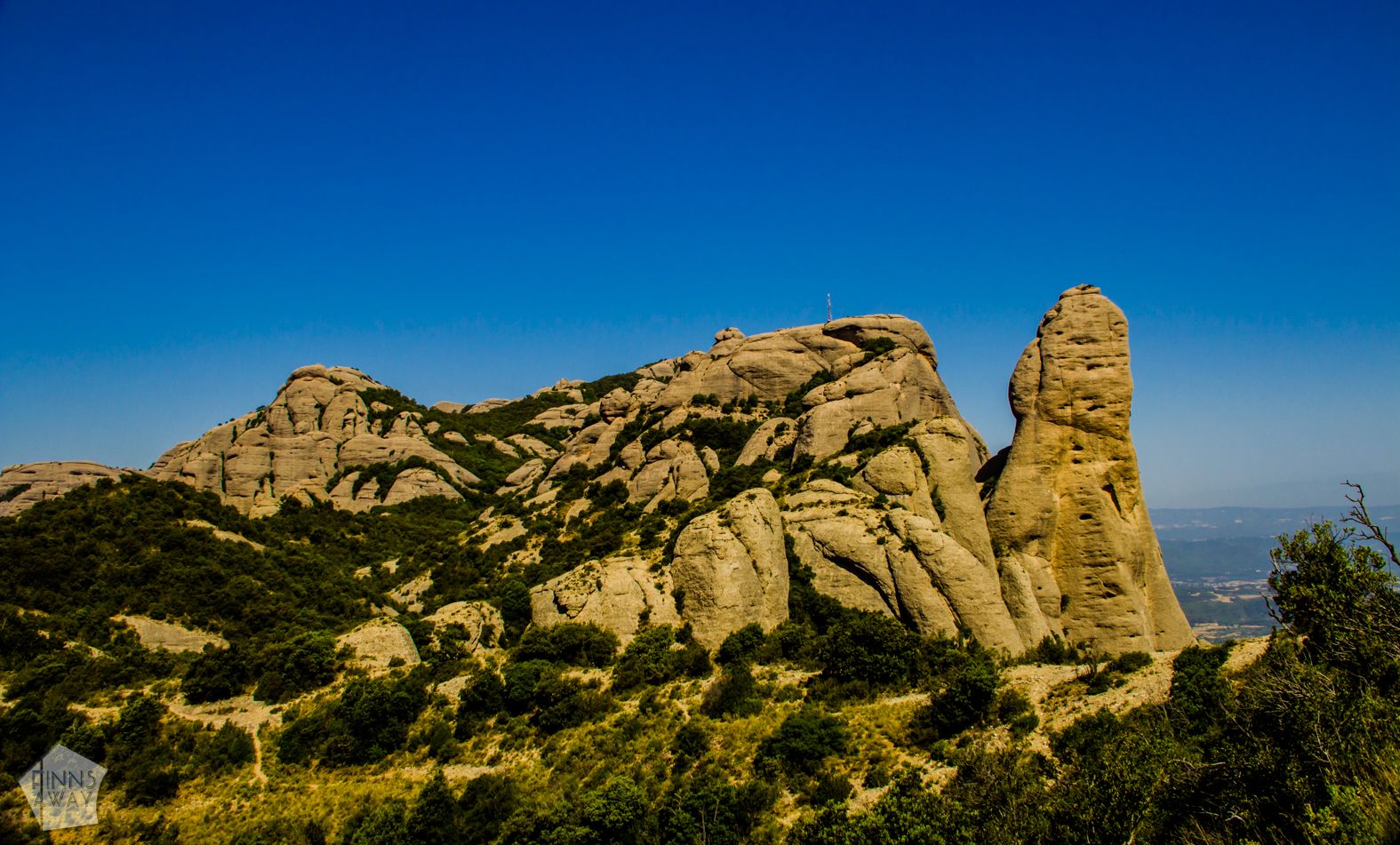
Probably the most popular hike in Montserrat is from the monastery to the highest peak, Sant Jeroni (1236 meters). It’s nice and relatively easy hike along well maintained, wide paths. You can begin the walk next to the tourist information of the monastery, or first take the Funicular de Sant Joan up closer to the peaks. The upper station of the funicular is a starting point to the main trail to the peak, Cami nou de Sant Jeroni. From the station it’s a 3,4 km hike (with 270 meters ascent) with wonderful views of the oddly-shaped rocks and through the forested valley between the peaks. Reaching Saint Jeroni peak takes from one to two and a half hours, depending on your pace and how often you stop for taking pictures.
If you’d rather avoid the pricey funicular (8,75 € for a single journey, 13,50 € for a round trip for adults), you should start the hike from the monastery. The route from there, called Escales dels Pobres, is actually not much longer than the one from the funicular station, but takes more time, as it comes with altogether 460 meters ascent and a lot of stairs in the beginning of the walk. Note that the trail from the monastery doesn’t lead to the funicular station, but joins the same trail later.
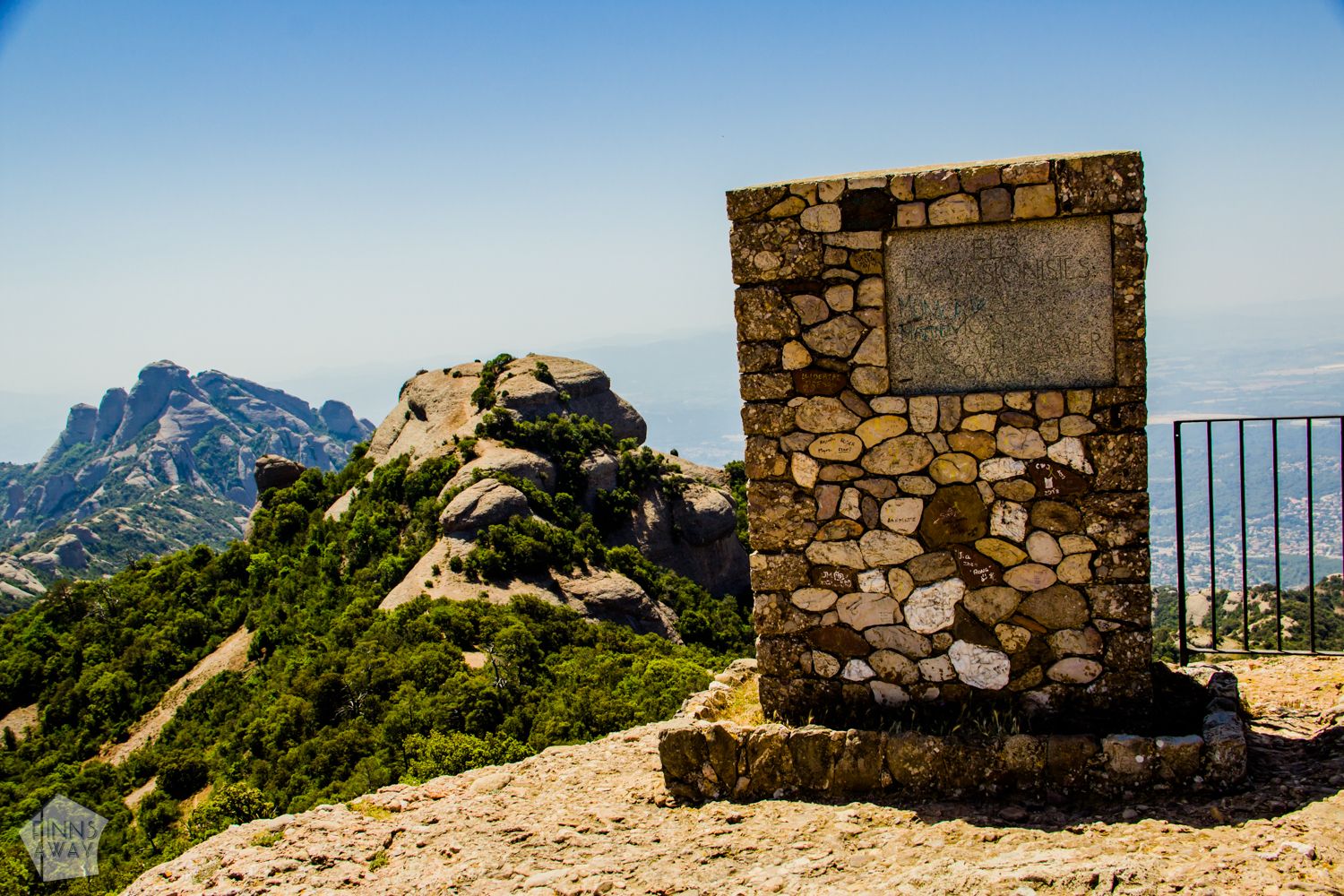 Sant Jeroni peak is not a narrow rock tower like many other peaks of Montserrat, but instead more round, and thus easy to get on top off, along a few sets of stairs. On top of the peak, there is a viewing platform from where you can admire the wonderful scenery, and on clear days you can see basically the whole Catalonia, Pyrenees Mountains and even the island of Mallorca. For the walk back, you can follow your tracks, but to enjoy different views, it’s advisable to choose another path. So in case you walked up from the monastery, take the path to the funicular station when going back. From behind the funicular station you’ll find a narrow road, called Cami de Sant Miquel, leading back to the monastery. And if you came from the funicular station, consider walking back down to the monastery along Escales dels Pobres.
If you’d like to avoid the main trails and take a longer route around the main massif and to the Sant Jeroni Peak, you can utilize the alternative paths in the Nature Park. Following the route of our hike below is one option, and this route described in summitpost website looks like a great option as well.
Our day hike in Montserrat Nature Park
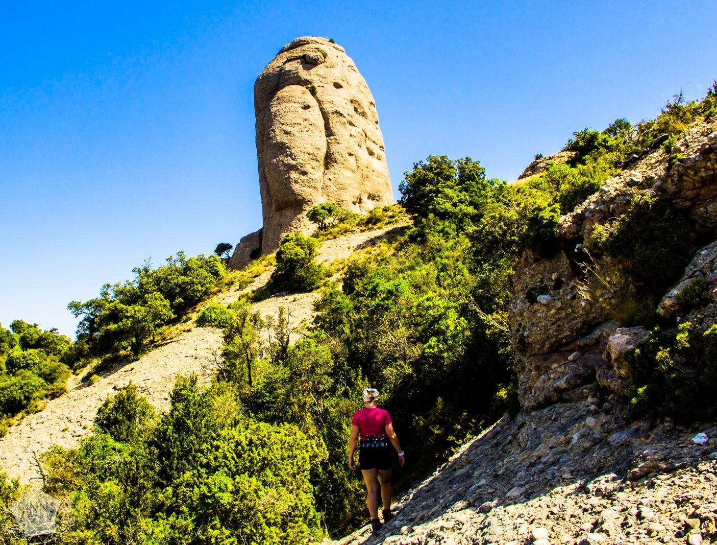 During our day hike in Montserrat Nature Park, we used partly the main trails, and partly some less-known paths that run between the rock formations. We started the hike from Camping Montserrat, where we stayed for two nights. Instead of heading up from there, we first walked down along the main road from the monastery (lined with a huge parking area) for roughly two kilometers, and hit the trails leading up to the mountain top from the first trail end along road BP-1103. From there, a steep path (Canal del Gat) climbs up, through forest and in between of peaks. This was not the most pleasant climb to be honest, with limited views and rather steep ascent. However, when you reach the summit area, the views are spectacular, and there is a nice path, Cami de l’Arrel, running past lines of wonderful rock formations, towards Sant Jeroni.
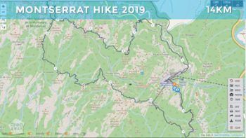
After walking 1,4 km along Cami de l’Arrel path, we reached the main trail Cami nou de Sant Jeroni, and walked along it on top of the peak. After admiring the scenery we started the hike back to the monastery, but instead of walking along the main trail, decided to find an alternative, longer route on the southern side of the summit valley. When climbing down from the peak, we turned right after the Monument a Verdaguer, taking a path leading south. The trail was mostly marked with yellow paint, and easy to follow, running in between of rocks and down to the valley. Nice, quiet and mostly very scenic path. There would have been optional trails for even longer hike, but we returned to the main path after three kilometers of walking. Then we continued to the upper station of the funicular, and back to the camping site along the small road from there. This circular hike was almost 14 kilometers long, with 820 meters total ascent, and it took us around six hours, including a couple of breaks and a lot of short photography stops.

Where to stay
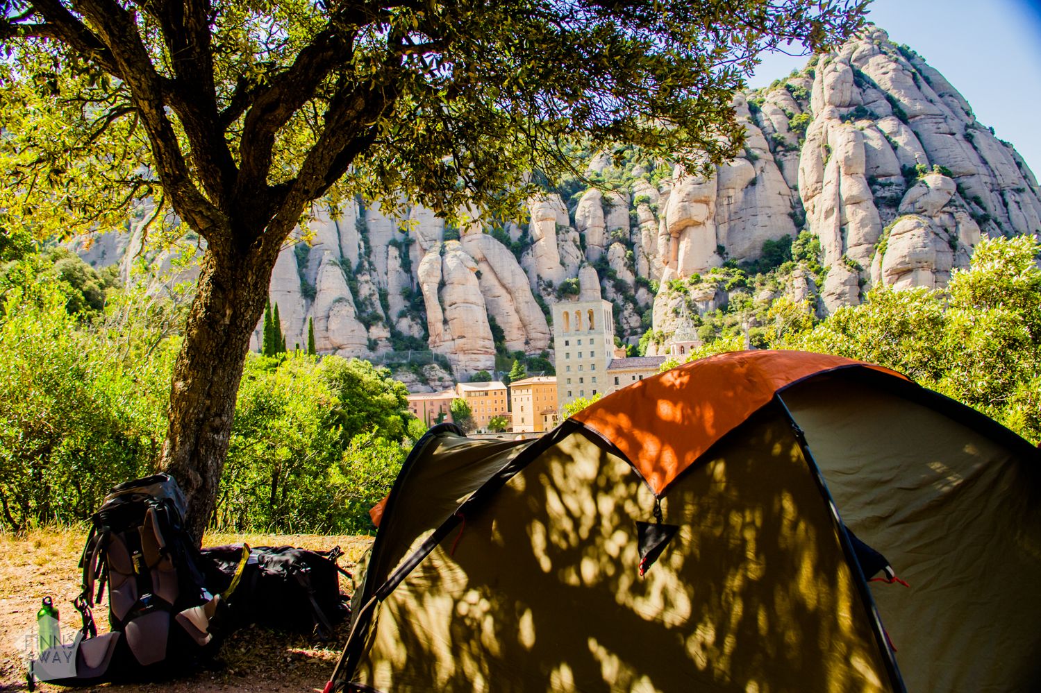 Check our guide post to Montserrat for information about accommodation options up in the monastery. For those with camping gear, a climbing-oriented Camping Montserrat, just a few hundred meters from the monastery, is an affordable option, and comes with wonderful views! In Spanish the campsite is called Area Esportiva i D’Acampada, and you’ll find it by following a road called Cami de Sant Miquel, that leads up from below the lower station of Sant Joan funicular.