FinnsAway blog – nomad life and travel adventures
Provence may be best known for photogenic landscapes filled with small villages, vineyards, lavender fields and olive groves, but it’s also home to impressive limestone mountains and deep gorges. The best known river valley is the one of Verdon River, that forms one of biggest canyons in Europe. With nearly vertical walls and a turquoise river in the bottom of the canyon, Verdon Gorge lures in notable amount of visitors, most of them driving along the winding roads on top of the gorge. However, the best way to explore it, is to hike down in the canyon. In this post we shortly introduce Verdon Gorge, and an amazing circular hiking route following the Sentier de l’Imbut and Sentier Vidal trails in the canyon. We did this hike in mid-June 2019.
Table of contest
Introducing Verdon Gorge
Is it dangerous to hike in Verdon Gorge?
Hiking Imbut and Vidal trails
Short facts of the hike
Tips for planning a visit to Verdon Gorge
Canyon of Verdon River
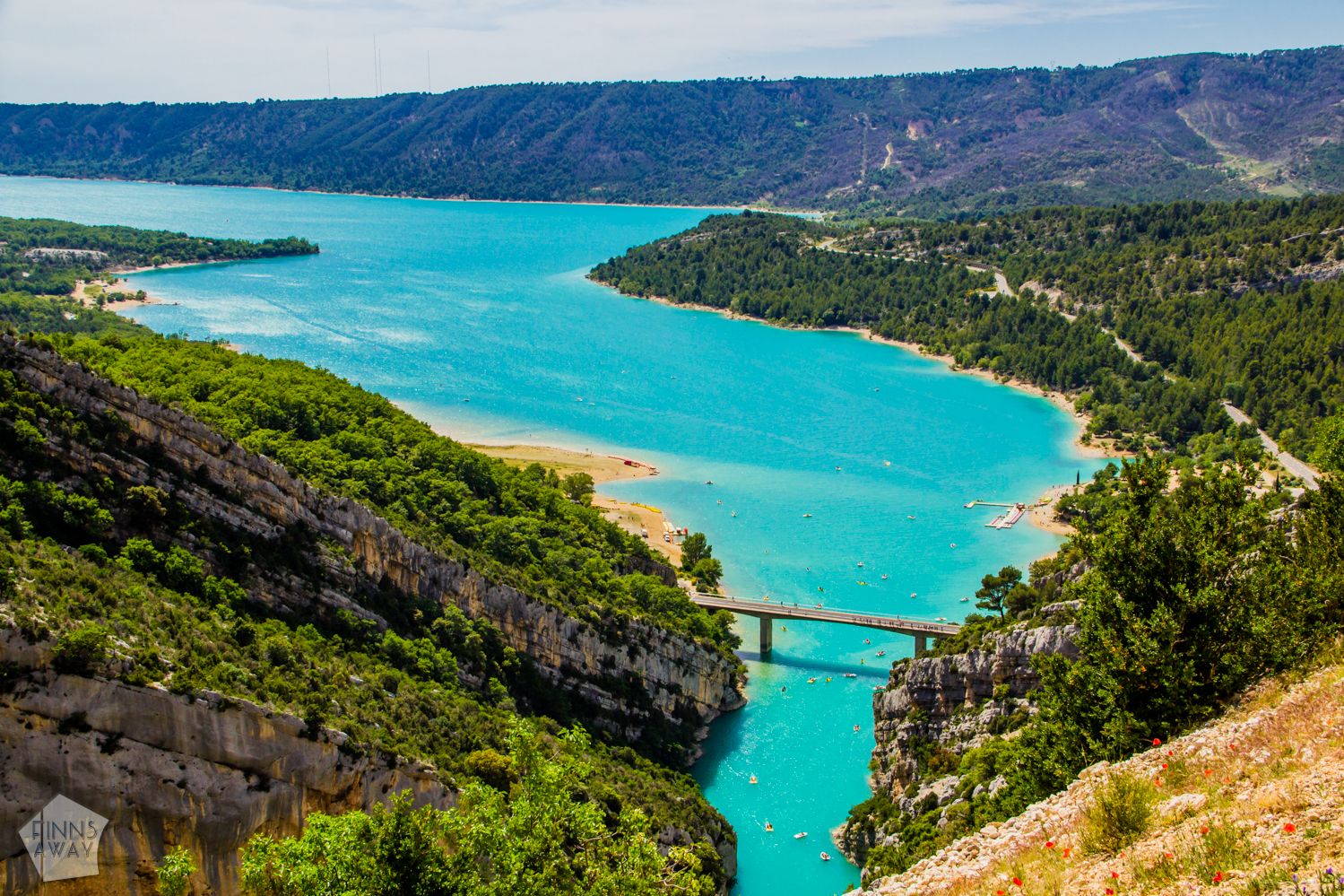
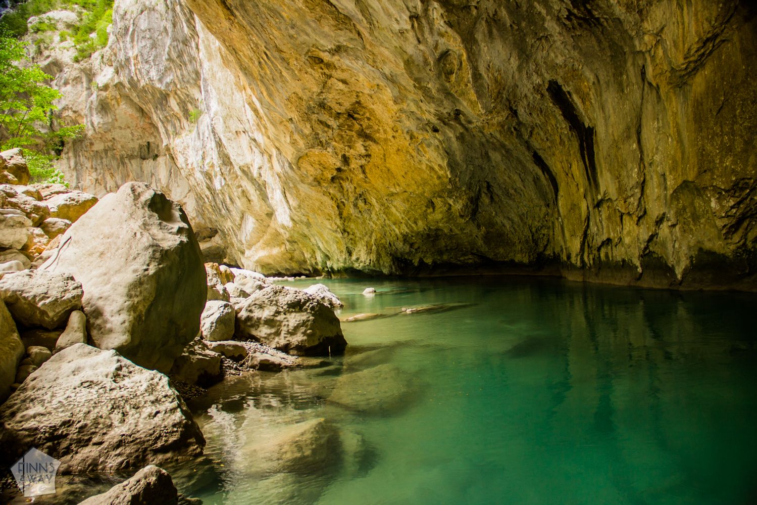
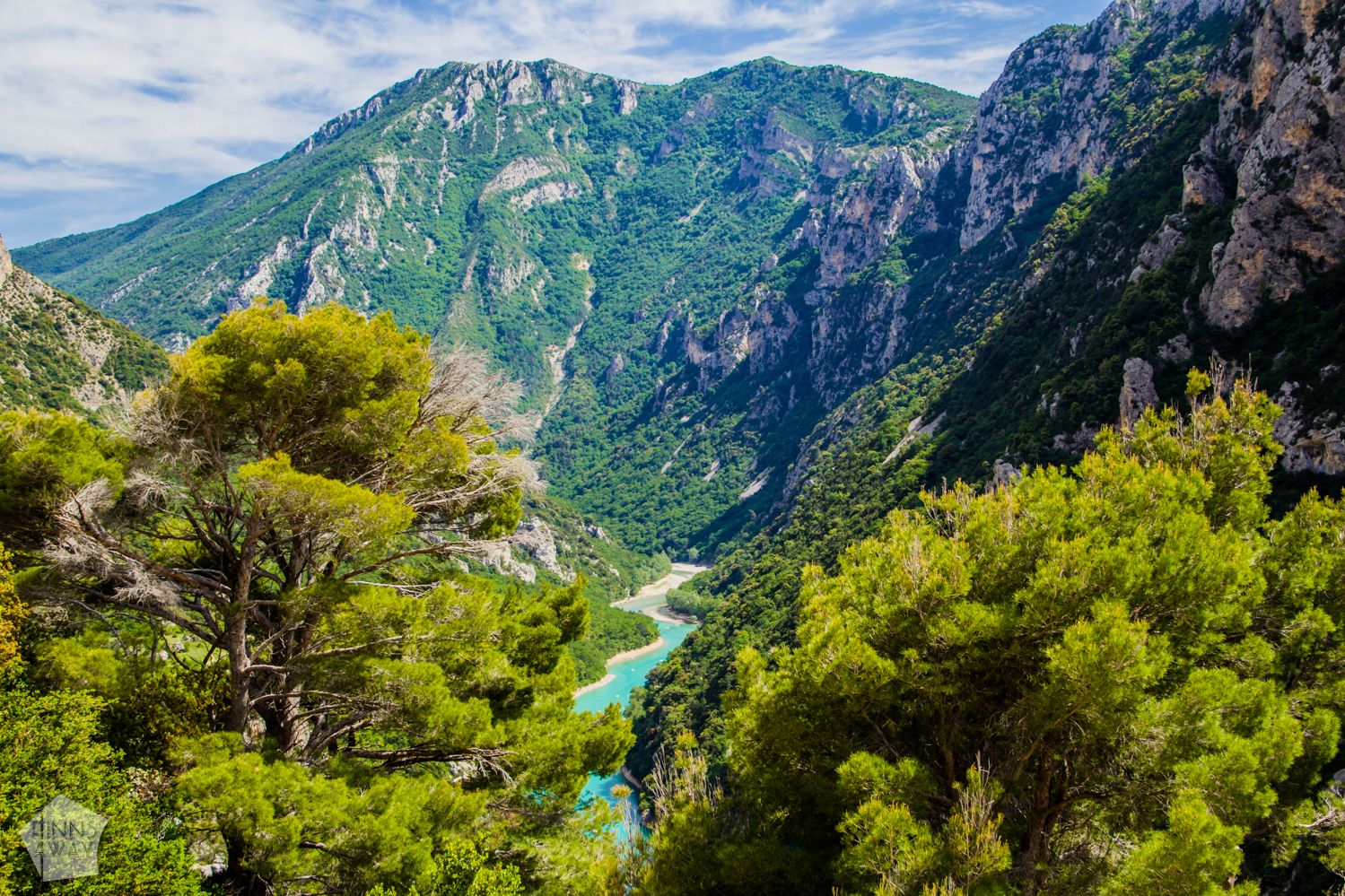 Verdon River flows roughly 170 kilometers from south-western Alps through Alpes-de-Haute-Provence area. Between the town of Castellane and the artificial lake of Sainte-Croix-de-Verdon, the river has formed up to 700 meters deep ravine through limestone. This part of Verdon Gorge is the most impressive, and offers plenty of possibilities for outdoor activities with breathtaking views, from rock-climbing to slowly paddling from the lake to the canyon. The color of the Verdon River, as well as the lake Sainte-Croix, is unbelievably turquoise, due to glacial minerals in the water. One of the special features of Verdon Canyon is called Imbut, a narrow section of the ravine, where the river disappears to underground galleries.
Is it dangerous to hike in Verdon Gorge?
The hike described in the post is probably the most scenic in Verdon Gorge, but also quite challenging and not suitable for those with fear of heights, or with bigger problems with knees. Making the full circle means a steep hike down to the gorge, walking short sections along paths cut up in the canyon wall and climbing up almost vertical wall, using steps carved in the rock, some ladders and supportive railings or wires. It may sound frightening, but as the supportive structures are in good condition, it felt pretty safe. Hiking sticks should not be used in ascents and descents, as you’ll need your hands for support.
 We wouldn’t recommend this hike for very inexperienced hikers, and would also advice not going if it’s raining, as the stone paths can get very slippery. You’ll see also a lot of warning signs that swimming is forbidden and hiking near the river is dangerous, because it’s possible that the water level can rise rapidly. During our hike we did see one rescue operation; as a hiker had hurt her leg and needed to be evacuated by a helicopter. With injured leg, it’s probably nearly impossible to climb back to the road. For emergencies like this, always take care that your insurance cover is sufficient. Finally, note that this hike should be done anticlockwise as in this guide, because the nearly vertical section of Vidal trail is much safer and easier going up than down.

Description of the Imbut and Vidal hike
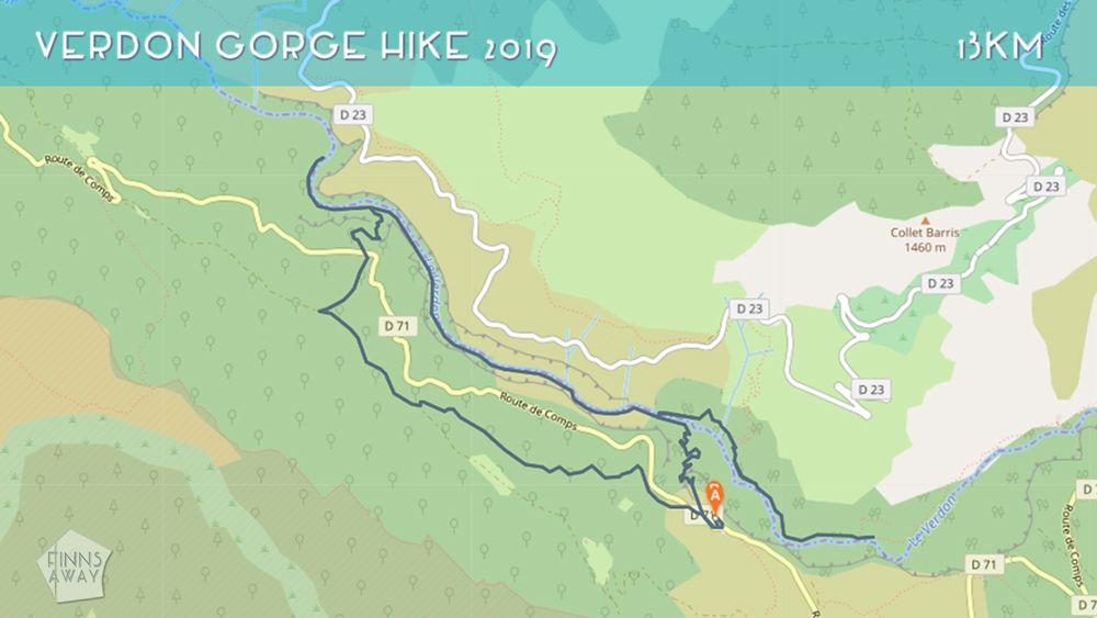
Assuming that you have your own wheels, begin the hike by leaving you car in the free Les Cavaliers parking lot by the road D71. This parking is outside Hotel and Restaurant Les Cavaliers, on the south side of the gorge, 15 km east from Aiguines village and 20 km from the lake Sainte-Croix. The Imbut trail begins by the road, west from the parking lot. There is a sizable sign with a map and information about the hiking trails. To locate the paths and ourselves, we used maps.me app, that offers detailed off-line maps (load them in advance) and GPS-tracking. Surely there are also paper maps available.
Down to Estelliers
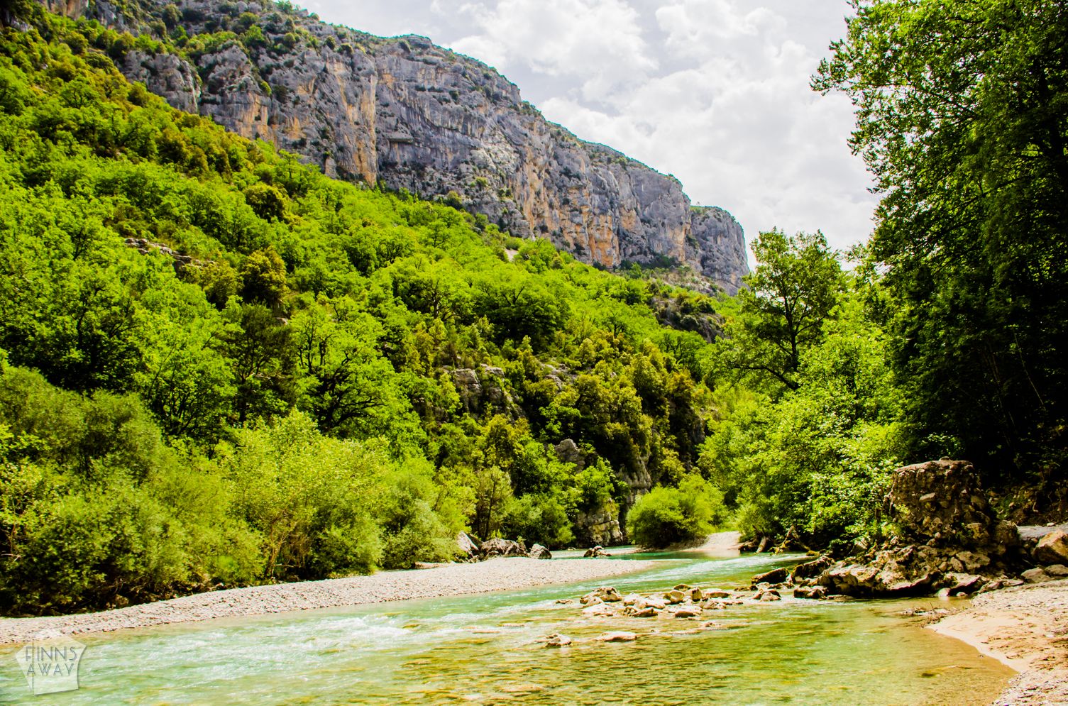 First section of the hike, known as Estelliers, takes you through a short forested section, along GR 99 trail down to the bottom of the gorge. It’s only a 1 km hike, but comes with over 200 meters descent and some quite steep sections. It’s not too difficult climb down though, and the steep sections are supported with railings. There are some great views along the way. When in the bottom of the canyon, you’ll first reach a pebbled beach and then a modern footbridge crossing the river in l’Estellé. To make only the circular hike, don’t cross the bridge, but continue west along the south bank of the river. It’s recommended however to go up on the bridge, as the location is very photogenic. We wanted to see the canyon also east from here, so we crossed the bridge and walked a couple of kilometers upstream along a path called Martel trail. This path on the northern side of the river is a quite popular hiking route, as it’s easy to walk and offers some great views from along the river, though partly the path goes in the woods. We soon headed back to Estellier bridge though, and started to follow the Imbut trail downstream.
Following the Imbut trail
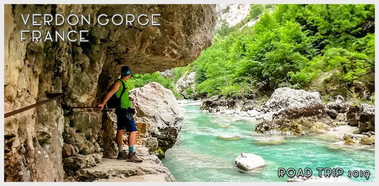
L’Imbut trail offers wonderful landscapes, as the path mostly follows the river very close to it. There is a section where the path dives in a humid forest, and at times it runs basically straight above the river, carved into the canyon wall. You will also walk past an impressive section of the river, where white, round limestone rock walls and basins form a narrow canyon inside the main canyon. This place is called Styx – based on Greek methodology the name means one of rivers leading to the underworld. Soon after the Styx, you’ll then hike higher again, and reach a ledge called Maugue, where the trail is carved into the rock wall. The path is only 70 cm wide and runs quite high above the river, but it is easy to walk and secured with handrails.
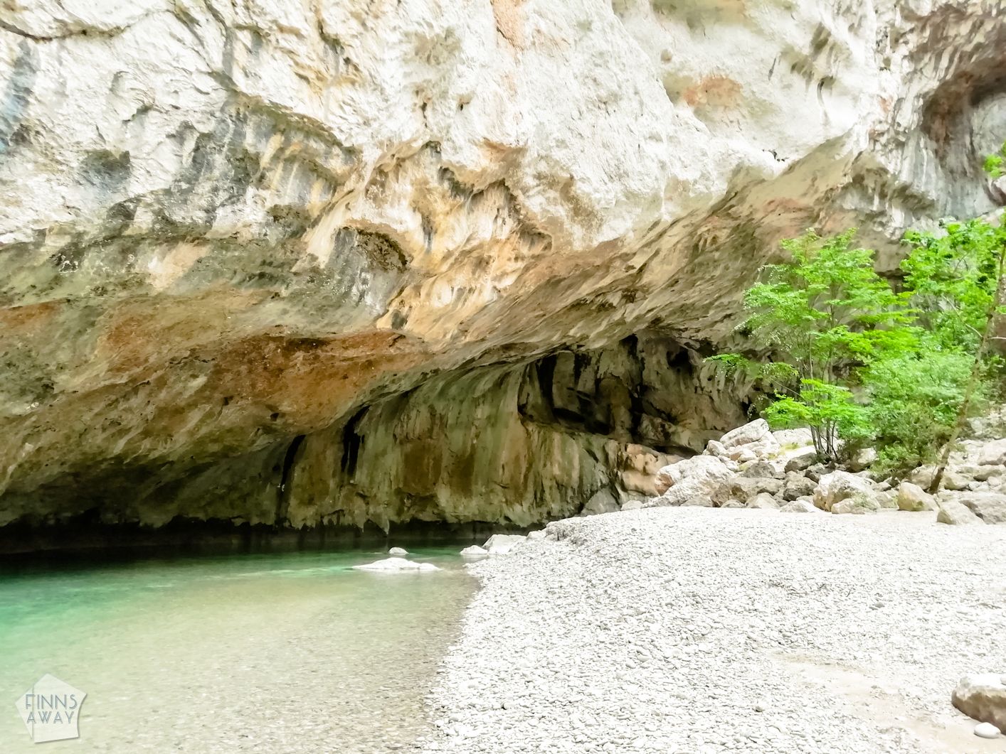 After walking roughly three kilometers from the bridge, the path climbs again higher to the woods, and reaches the crossroads with Sentier Vidal trail. This is where the climb back up begins, but it’s recommended to continue further downstream to reach the Imbut, where the canyon narrows and river disappears to an underpass. The path towards l’Imbut goes up and down, but is easy to follow. In about 20 minutes you’ll reach a pebbled beach and see how the walls get closer together. This looks like the trail end, but you can still continue bouldering over and around huge rocks, following white painted marks. It’s quite challenging at times to find your way, and might feel impossible if you have no experience on climbing. After 15 minutes or so, you’ll reach a beautiful beach called Baou Beni, where the trail ends.
Climb up along Vidal trail
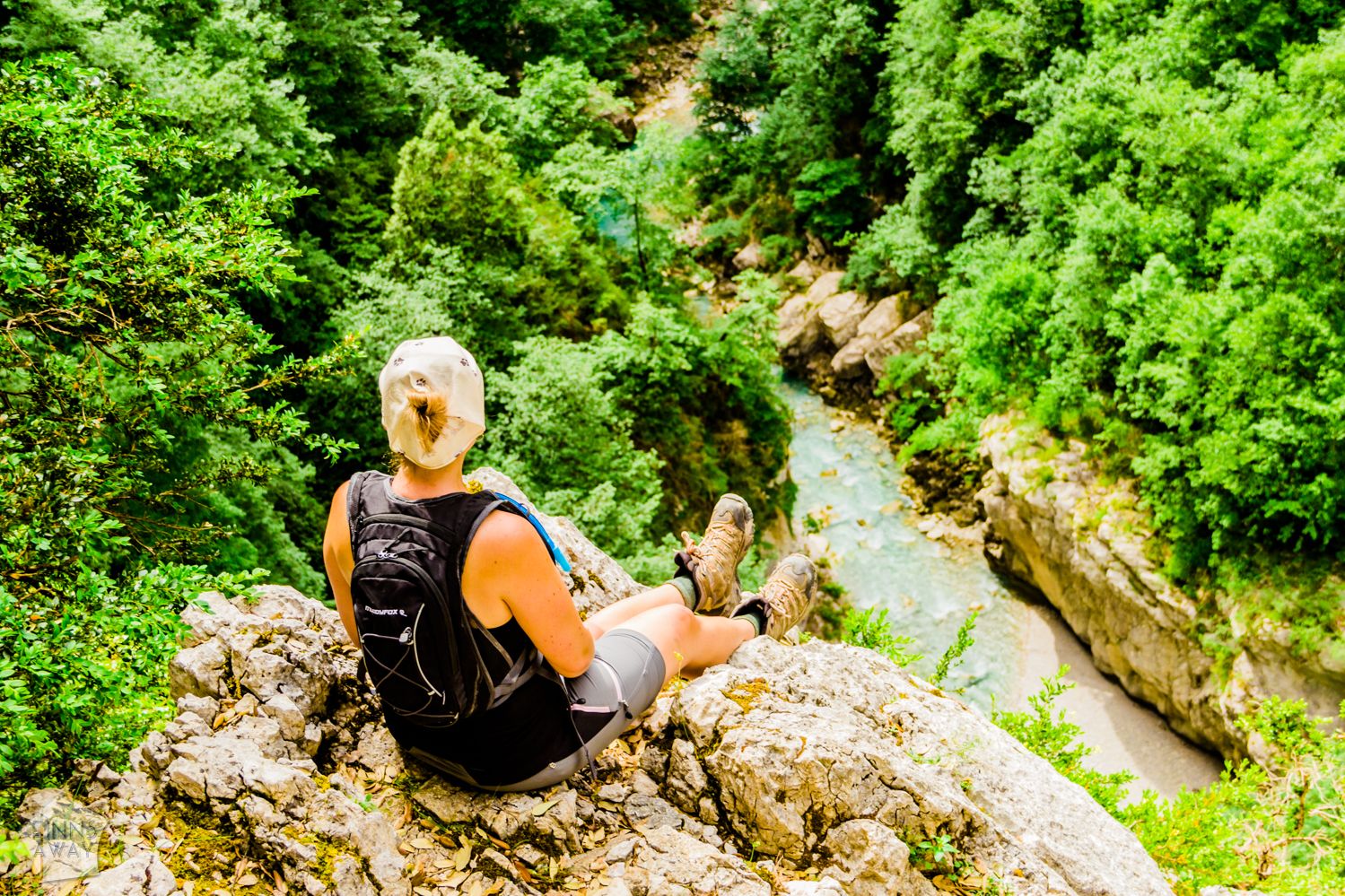 After admiring the narrow part of Verdon Gorge, walk back to the crossroads of Vidal trail. The most impressive and steep section of the climb begins almost right away. This path, that is partly cut into the rock wall, was originally made to serve as an emergency exit, and has been improved by adding safety equipment such as strong handrails. It may not be suitable for the most faint-hearted, but we at least felt safe when climbing up. There are some great views downwards on the way up, so take your time and have some breaks for catching your breath and taking pictures. After around an hour of climbing and walking up, you’ll reach the main road up above the gorge.
Walk back to the parking
From the upper end of Vidal trail, it’s roughly 3 km back to the parking lot. You can walk along the main road, but there usually is quite a lot of traffic. Another option is to cross the road and follow the yellow marked path up the hill, and then trail GR99 back to the parking lot. We chose the trail option, and it was a nice and easy walk. There are not too great views to the canyon though, as the path mostly runs in a forest.